Stunning multi-day hikes: From coastal treks to desert adventures
Experience some of Australia’s finest trails, offering routes through wild islands, past clifftop waterfalls, and along sandy coastlines. Whether you prefer a short walk along the glistening coastline of New South Wales’ Central Coast or a multi-day trek through the Northern Territory desert, there is a diverse range of options to explore. This roundup highlights the best multi-day walks in Australia, from the white sands of Great Sandy National Park to the rugged wilderness of Nitmiluk National Park. How many of these remarkable trails have you experienced?
OVERLAND TRACK
Where: Cradle Mountain-Lake St Clair National Park, Tasmania
Duration: 5-7 days
Distance: 65km
Grade: 4 (Hard)
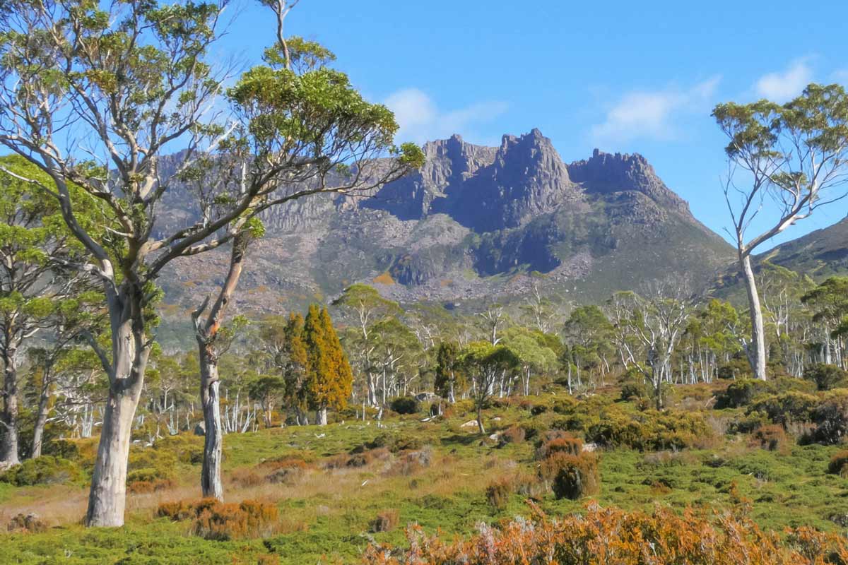
Tasmania boasts an array of exceptional walking trails, with the Overland Track standing out as a true icon. This trail meanders through moss-covered forests and past impressive bluffs over six picturesque days. For those seeking flexibility, tackling the track independently is an option, while the Cradle Mountain Signature Walk offers a more luxurious experience, featuring cosy private huts to retreat to at the end of each demanding day. Given Tasmania’s unpredictable weather, hikers should be prepared for varying conditions to fully enjoy the adventure.
Spanning five to seven days, the Overland Track traverses the breathtaking World Heritage–listed landscapes of Cradle Mountain-Lake St Clair National Park. Renowned as Australia’s most famous multi-day wilderness trek, this well-marked path winds between mountains rather than over them, making it an achievable journey for experienced multi-day hikers with a reasonable level of fitness. Along the route, a limited number of dormitory beds in seven hiking huts are available on a first-come, first-served basis. Independent hikers must carry a tent, cooking equipment, and food for the entire journey. For those desiring more comfort, the Tasmanian Walking Company offers guided walks that include meals and lodging at exclusive private accommodations discreetly located off the main trail.
Most hikers undertake the Overland Track during the warmer months from October to May, when longer daylight hours provide ample opportunity for exploration and even a bracing swim in one of the cold alpine tarns. During this period, a permit is required, and the track can only be hiked in one direction: north to south. With the permit system limiting departures to 35 independent hikers per day, the trail remains uncrowded, allowing for a serene experience. In winter, hikers can enjoy the trail’s solitude and icy beauty, although freezing temperatures and snow render it suitable only for expert hikers.
The Overland Track features diverse terrains, including high alpine moors, rocky scree, gorges, and towering rainforests. Notable side trips include the summit of Mt Ossa, Tasmania’s highest peak at 1617 metres, and several spectacular waterfalls. Wildlife such as wombats and pademelons are commonly sighted along the path, and a rich variety of colourful fungi can be observed by those who take the time to look closely.
CAPE TO CAPE TRACK
Where: Margaret River region, Western Australia
Duration: 6-7 days
Distance: 135km
Grade: 4 (Hard)
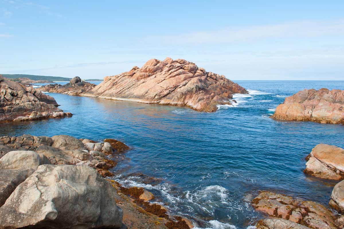
The Cape-to-Cape Track winds along the Margaret River region’s coastline, offering a diverse landscape of dramatic cliffs, hidden cave networks, breezy forests, and pristine beaches. Each day unveils a new adventure as you traverse this 135km path. The track follows the Leeuwin-Naturaliste National Park and borders the Ngari Capes Marine Park, providing a constant interplay between breathtaking cliff-top vistas and stretches of secluded beaches.
Marine life enthusiasts will be delighted by the possibility of year-round dolphin sightings. Between June and September, whales migrating between the Southern Ocean and northern breeding grounds grace the coast. Humpback whales, known for their spectacular breaches, are most frequent, but sightings of southern right whales and even the colossal blue whale are possible. While the coastal scenery is a highlight, the track ventures inland through sheltered woodlands and the magnificent Boranup Forest with its towering karri trees.
The terrain varies throughout the track. The section near Cape Naturaliste offers a gentle incline and a smooth, wide surface, ideal for casual walkers. In contrast, other sections present challenges with steep, rocky paths and soft sand. The track is primarily for walkers, though it occasionally follows sections of four-wheel drive tracks used by surfers accessing popular breaks.
Completing the entire track is a rewarding challenge, typically taking 5-7 days. However, multiple access points allow walkers to experience the Cape-to-Cape Track in smaller sections. Accommodation options range from basic campsites for dedicated walkers to campgrounds with amenities and vehicle access. The Margaret River region, renowned for its wineries, offers a variety of lodging choices, including luxurious options.
The Margaret River, roughly halfway along the track, can be cautiously crossed at its mouth for most of the year. However, winter conditions can render the crossing unsafe, necessitating an inland detour via a bridge further upstream. Vehicle access to the river mouth is only available from the south, meaning northbound walkers must backtrack if unable to cross.
The Cape-to-Cape Track is open year-round, with refreshing sea breezes tempering the summer heat. It’s important to note that fire danger remains high during this period, with strong winds further escalating the risk. Leeuwin-Naturaliste National Park is a popular tourist destination. Hikers planning to tackle the Cape-to-Cape Track during peak seasons should secure accommodation well in advance and consider allocating extra travel time from Perth.
LARAPINTA TRAIL
Where: West MacDonnell National Park, Northern Territory
Duration: 12-20 days
Distance: 223km
Grade: 4 (Hard)
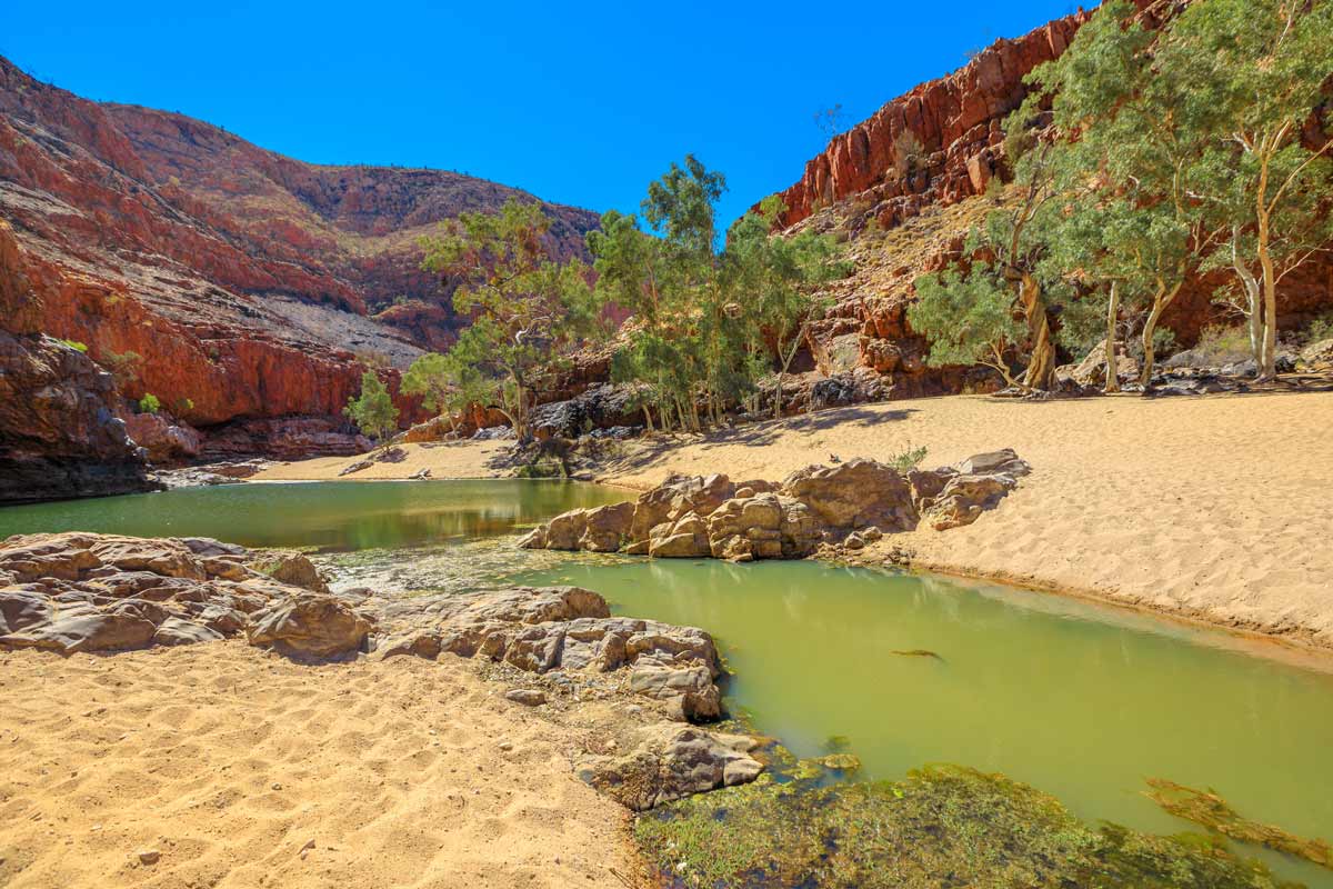
The Larapinta Trail, a crown jewel of outback hikes in Australia, traverses the heart of the Northern Territory’s rugged West MacDonnell Ranges. Towering red rock escarpments, refreshing waterholes, and culturally significant Aboriginal sites are just a few of the treasures that await hikers on this challenging yet rewarding trek.
The 223-kilometer trail, the Northern Territory’s most famous long-distance walk, winds its way along the spine of Tjoritja/West MacDonnell National Park. Divided into 12 sections of varying difficulty, it stretches from Alice Springs Telegraph Station to the summit of Mount Sonder, the range’s western peak at 1,380 meters.
Each section can be completed in one or two days, offering flexibility for those seeking a shorter adventure or a multi-day challenge. The trail leads past many of the region’s natural wonders, attracting day-trippers from Alice Springs. Sections four (Standley Chasm to Birthday Waterhole) and five (Birthday Waterhole to Hugh Gorge) are particularly renowned for their scenic beauty, featuring challenging climbs, rocky terrain, and breathtaking views from Brinkley Bluff (section four) and the stretch between Linear Valley and Hugh Gorge (section five). The reward for exertion includes refreshing dips in secluded waterholes.
Accessibility is another advantage. Vehicle access points at most sections allow hikers to join or leave the trail at their convenience. Strategically placed water tanks at each trailhead ensure a readily available water supply for each leg of the journey. Independent hikers will need to be self-sufficient with food and camping gear, as public transportation isn’t available in the area. However, transfer services can be arranged through the Alice Wanderer.
GREAT OCEAN WALK
Where: Great Otway National Park, Victoria
Duration: 8-10 days
Distance: 100km
Grade: 4 (Hard)
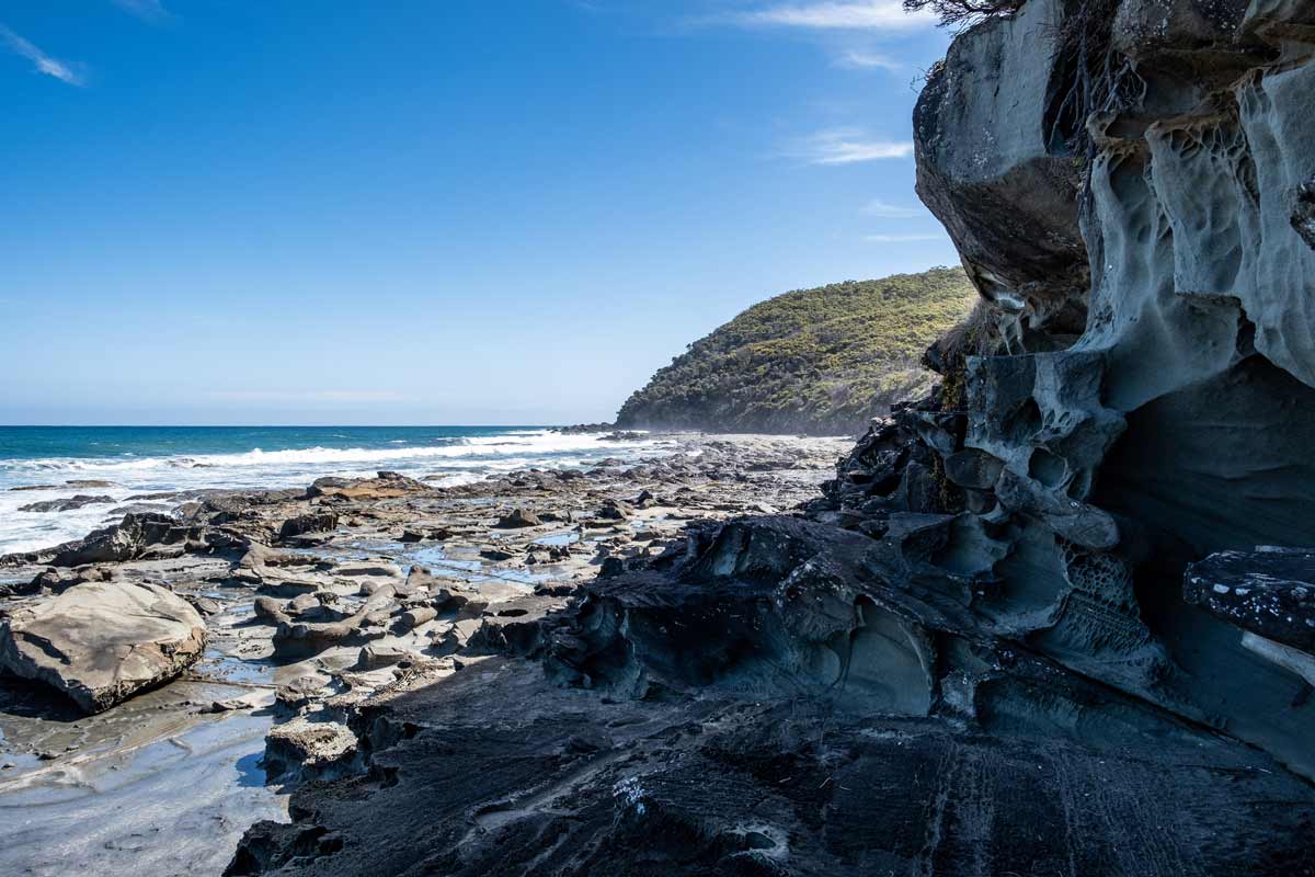
The Great Ocean Road is a world-renowned scenic drive, but Victoria offers a unique way to experience its beauty on foot – the Great Ocean Walk. This multi-day trek starts in the charming fishing village of Apollo Bay and winds along dramatic coastal cliffs and pristine beaches, offering close-up encounters with landmarks like the famed 12 Apostles.
The walk caters to different preferences. Choose self-guided exploration to set your own pace and immerse yourself in the scenery. Opt for a guided tour if you prefer to forgo carrying camping gear and enjoy creature comforts. The trail itself is relatively easy to navigate, transitioning through diverse landscapes: spectacular clifftops, deserted beaches, and the lush eucalypt forests of Great Otway National Park.
Accommodation options are flexible. Camp at designated sites specifically for walkers or choose comfort by staying in coastal villages with a variety of B&Bs, hotels, and lodges accessible from nearby trailheads. The trail is designed for east-to-west travel and can be easily broken down into shorter segments to suit your timeframe. Public transport might be limited, so pre-arrange pick-up if needed to avoid missing your planned route.
This captivating walk weaves through Great Otway National Park, showcasing tall forests, coastal heathlands, wild rocky shores, and windswept clifftops with breathtaking views. Whether you choose to experience the entire trail or create your own itinerary with specific highlights, the Great Ocean Walk promises an unforgettable exploration of Victoria’s dramatic coastline.
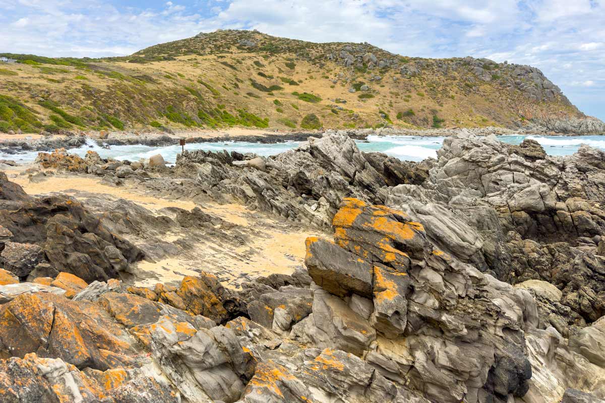
Australia’s longest dedicated walking trail, the Heysen Trail, also boasts some of the wildest scenery. Explore vibrant landscapes, from the rolling hills and vineyards of the Fleurieu Peninsula to the rugged peaks of the Flinders Ranges. Spot kangaroos, rock wallabies, and echidnas as you navigate through deep gorges and alongside trickling creeks. The Heysen Trail caters to all abilities. Complete the entire distance in sections or choose from numerous shorter walks that offer a taste of the diverse terrain.
The trail stretches from Cape Jervis on the Fleurieu Peninsula to Parachilna Gorge in the Flinders Ranges. As you journey north, the scenery transforms, showcasing South Australia’s natural beauty. Highlights include Wilpena Pound, a vast natural amphitheatre within Ikara-Flinders Ranges National Park, and the verdant vineyards of the Barossa Valley wine region.
Campgrounds and huts dot the trail, with some requiring bookings in advance. Conveniently, the trail also passes through or near towns, offering opportunities to restock supplies, enjoy a comfortable bed at various accommodations, and explore shorter walking routes.
The southern section, from Cape Jervis to Spalding (just north of the Clare Valley wine region), is considered less challenging and ideal for families. Hikers seeking a more demanding experience with greater solitude can opt for the more rugged and remote northern section, stretching from Spalding to Parachilna Gorge. Be aware that fire restrictions may close some sections during the summer months (December-April).
KANGAROO ISLAND WILDERNESS TRAIL
Where: Flinders Chase National Park, South Australia
Duration: 5 days
Distance: 62km
Grade: 4 (Hard)
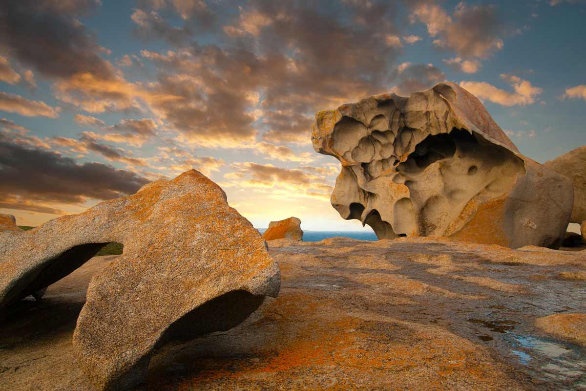
Kangaroo Island, a captivating island teeming with native wildlife and fringed by windswept coastlines, offers an unforgettable adventure on the Kangaroo Island Wilderness Trail. This 62-kilometer, five-day trek immerses you in nature’s wonders, from the dense eucalypt woodlands of Flinders Chase National Park to the otherworldly Remarkable Rocks.
The trail unfolds secrets with every step. Traverse South Australia’s most botanically diverse region, teeming with unique flora, before reaching the rugged and spectacular coastline of the Southern Ocean. Witness the unimaginable beauty firsthand – towering cliffs, hidden coves, and vast stretches of pristine beaches. Reconnect with nature from sunrise to sunset, with opportunities for wildlife sightings ranging from iconic kangaroos and koalas to playful dolphins and majestic whales depending on the season.
Bookings are required for this world-class experience. Choose to explore independently, planning your campsites and meals, for a truly immersive adventure. Alternatively, join a guided tour to benefit from expert knowledge, delicious meals prepared for you, and comfortable overnight stays in secluded locations. This is more than a hike; it’s a journey of rejuvenation, a chance to discover the island’s magic for yourself, and create memories that will last a lifetime.
THREE CAPES TRACK
Where: Cape Pillar State Reserve, Tasmania
Duration: 4 days
Distance: 46km
Grade: 3 (Moderate)
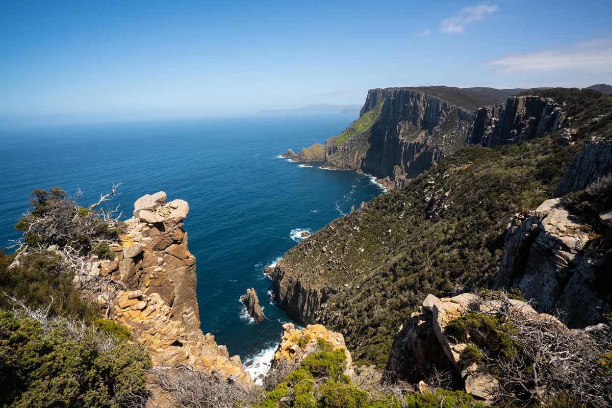
Tasmania’s Three Capes Track carves a path through Tasman National Park, offering a remote and dramatic four-day journey along the island’s southeastern coastline. Towering clifftops, the ever-present roar of the Southern Ocean, and a sense of solitude define this experience.
The track caters to both independent and guided exploration. Hike independently for a self-reliant adventure, planning meals and utilizing the comfortable, eco-friendly bunkhouse accommodation provided at designated points along the trail. Alternatively, join the Three Capes Signature Walk for expert guidance, delicious meals, and unique overnight stays.
While some sections are accessible for day hikes, the classic Three Capes experience is a one-way, three-night adventure. Packages typically include a boat transfer from the Port Arthur Historic Site to the trailhead and a return bus service at the conclusion. Day trips back to Hobart are readily available from Port Arthur for those who haven’t driven.
The Three Capes Track offers a unique blend of diverse ecosystems. Traverse fragrant eucalypt forests, vibrant coastal heathlands adorned with rare blooms, ancient moss-laden rainforests, and windswept cliffs that plummet dramatically towards the Southern Ocean. Be rewarded with sightings of native wildlife, like echidnas, while immersing yourself in the raw and untamed beauty of the Tasmanian coast.

BIBBULMUN TRACK
Where: South West Western Australia
Duration: 8 weeks
Distance: 1,000km
Grade: 4 (Hard)
The Bibbulmun Track, a crown jewel of Western Australia’s hiking trails, traverses the heart of the state’s stunning southwest corner. This long-distance track, often compared to the Appalachian Trail in the eastern United States, stretches for over 1,000 kilometres from Kalamunda near Perth to Albany on the south coast.
The Bibbulmun Track caters to all levels of ambition. Day walks are accessible from various towns along the route, offering a taste of the diverse scenery. Hikers seeking a longer challenge can embark on multi-day adventures, or even the epic eight-week journey to experience the full majesty of the trail.
Towering karri forests, unique to this region, line parts of the track, while other sections reveal soft sand dunes, dramatic coastal lookouts, and the untamed power of the Southern Ocean. Hikers are rewarded with unmatched sunsets, giant granite boulders, and tranquil misty valleys.
The trail is divided into nine sections, each connected by a town offering amenities, resupply opportunities, and shorter walk options. While some sections, particularly those affected by bushfire, may appear repetitive to thru-hikers, the overall experience is rich in variety. Highlights include towering jarrah and marri forests, close encounters with the wild coastline between Northcliffe and Walpole, and the camaraderie of fellow hikers encountered on the trail and at the 49 basic campsites scattered along the way.
For optimal conditions, plan your hike between September and November when wildflowers are in bloom and the weather is mild. Avoid long hikes during December to March due to the increased risk of bushfires.
K’GARI GREAT WALK
Where: Great Sandy National Park, Queensland
Duration: 6-8 days
Distance: 90km
Grade: 4 (Hard)
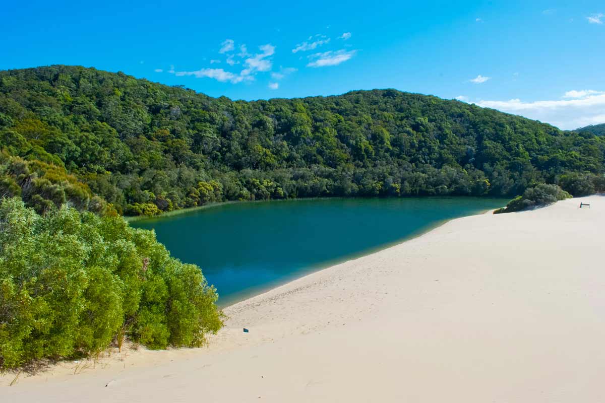
Unveiling the wonders of K’gari (Fraser Island), the world’s largest sand island, the K’gari Great Walk offers a multi-day adventure through diverse landscapes. Hike for eight days to complete the entire 90-kilometer trail or choose shorter options like the Lake Wabby Walk for a more manageable experience. The island’s heart reveals secluded beauty, a haven for those seeking tranquillity and exploration beyond the usual tourist spots. Remember to book campsites in advance for a safe and comfortable journey.
Whether you’re a seasoned hiker or a weekend adventurer seeking a digital detox, the K’gari Great Walk promises an unforgettable connection with nature. Explore at your own pace, tackling the entire route in sections or focusing on shorter segments that pique your interest. World Heritage-listed K’gari provides the perfect backdrop to slow down and immerse yourself in its diverse ecosystems. Traverse coastal wallum, a unique ecosystem of coastal heaths and woodlands, teeming with colourful wildflowers in spring.
Explore lush woodlands teeming with towering eucalyptus trees and vibrant birdlife. Discover the island’s central subtropical rainforests, a cool and refreshing oasis with ancient trees draped in vines and ferns. As you reach your daily destination, set up camp amidst this natural wonderland and unwind under the starry sky, lulled by the gentle sounds of nature. Whether you encounter playful wallabies emerging from the bush or spot majestic dingoes silhouetted against the sunset, the K’gari Great Walk promises an unforgettable encounter with K’gari’s unique wildlife.
JATBULA TRAIL
Where: Nitmiluk National Park, Northern Territory
Duration: 5 days
Distance: 62km
Grade: 4 (Hard)
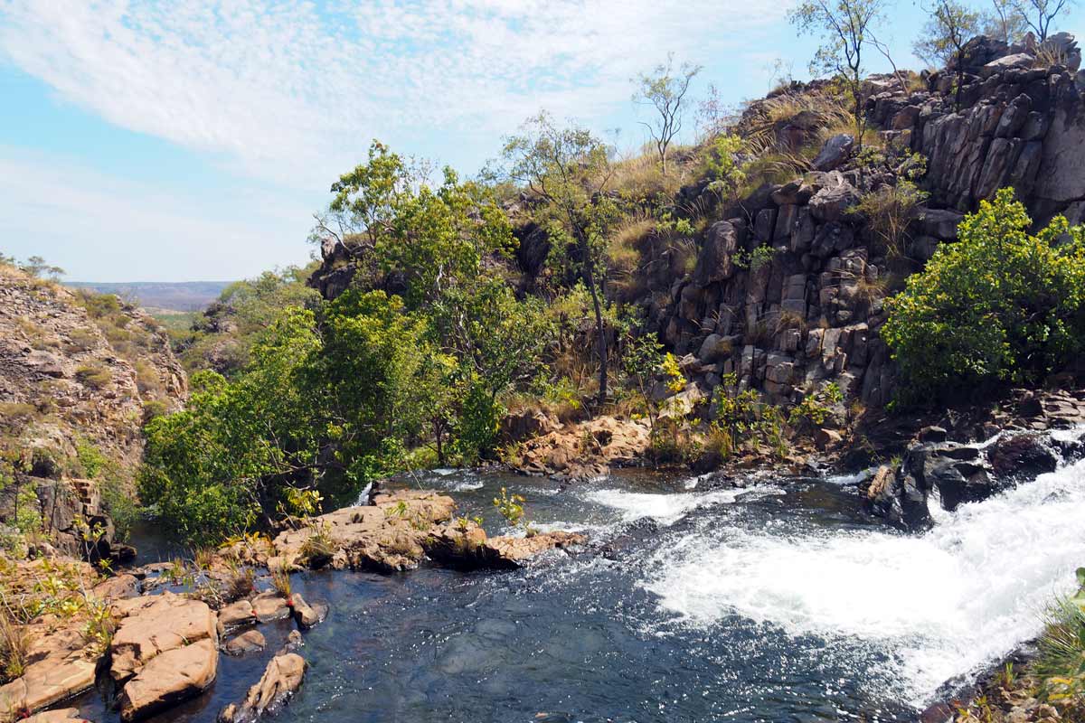
The Jatbula Trail in Nitmiluk National Park, Northern Territory, carves a path through more than just stunning scenery. This 62-kilometer trek through the heart of the Top End follows an ancient Aboriginal Songline, a pathway traditionally used by the Jawoyn people for generations. Walk from Nitmiluk Gorge (Katherine Gorge) to Leliyn (Edith Falls), witnessing thunderous waterfalls cascading over sandstone cliffs into cool, forest creeks.
Named after Jawoyn Traditional Owner Peter Jatbula, who played a vital role in securing land rights for his people, the trail winds its way along the western edge of the Arnhem Land escarpment. The landscape itself transforms throughout the journey. Hike across sandstone plateaus, delve into shady woodlands and open forests, trek through monsoon rainforests teeming with life, and follow riverine paths teeming with birdlife. This diverse terrain is a testament to the rich cultural heritage of the Jawoyn people. Visit ancient rock art sites scattered along the trail and gain a deeper appreciation for their enduring connection to this land.
The Jatbula Trail is more than just a hike; it’s an immersive wilderness adventure. Traverse the exceptional Arnhem Land Escarpment and Stone Country, marvelling at waterfalls cascading down towering sandstone cliffs. Witness the dramatic shift in scenery as towering escarpments meet lush monsoon forests. Camp under a canopy of stars at designated, well-maintained campsites, and cool off with refreshing dips in the many waterholes that dot the trail. This unforgettable journey promises rejuvenation and a profound connection to this unique part of Australia.
Consider combining the Jatbula Trail with a Katherine River Canoe Expedition for the complete Top End experience. Paddle through Nitmiluk Gorge (Katherine Gorge), a network of 13 gorges carved from ancient sandstone, and witness Aboriginal rock art from a different perspective. This combined adventure offers a deeper appreciation for the natural and cultural wonders of the Northern Territory.
THORSBORNE TRAIL
Where: Hinchinbrook Island National Park, Queensland
Duration: 4-5 days
Distance: 32km
Grade: 5 (Difficult)
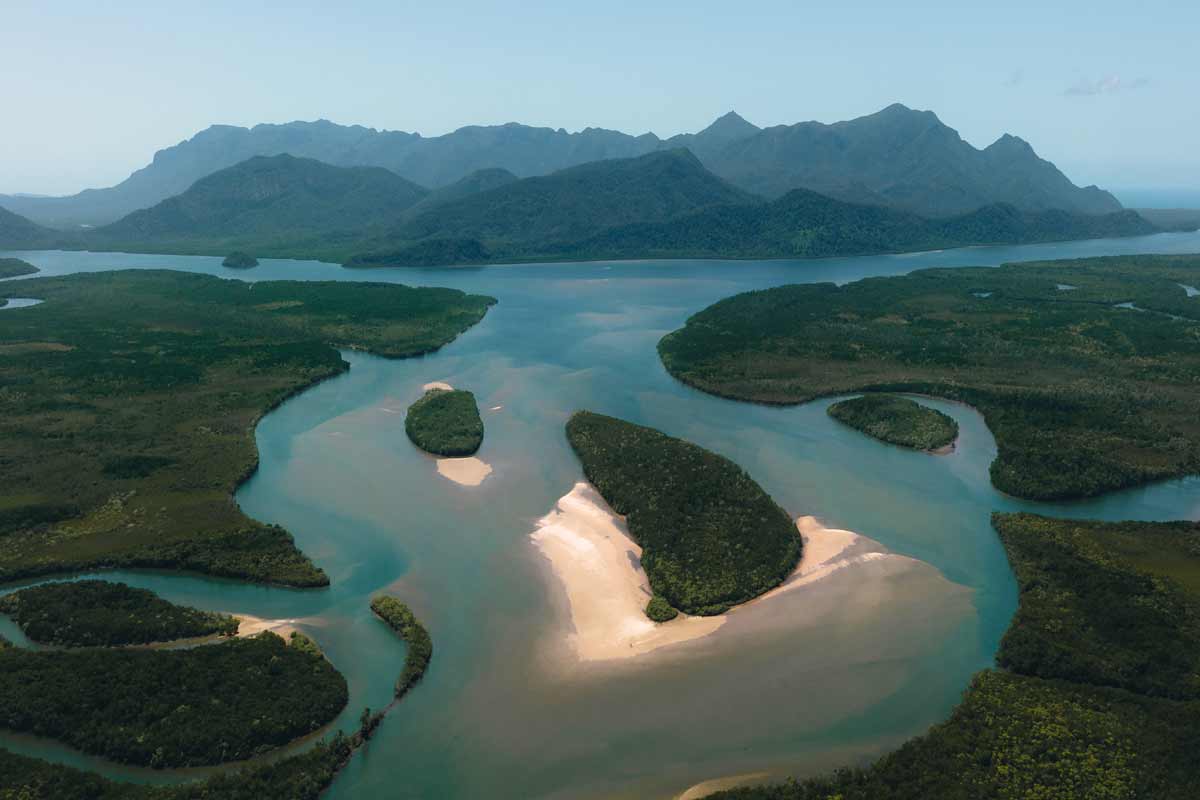
A jewel of Queensland’s coast, Hinchinbrook Island National Park boasts the title of Australia’s largest island national park. This 399-square-kilometer sanctuary of pristine wilderness lies off the northern coast, between Townsville and Cairns. Dramatic granite mountains rise from the sea, their slopes contrasting with the lush tropical rainforests that cloak the mainland side. Known as Munamudanamy to the Bandjin and Girramay Traditional Custodians, this island offers a diverse landscape. Long sandy beaches fringe the east coast, where tangled mangrove forests thrive.
The Thorsborne Trail traces this eastern shore. Untamed and unpaved, the track presents a challenging yet rewarding experience for experienced hikers. Navigate creek crossings, delve into thick rainforest, and encounter cascading waterfalls – all hallmarks of this incredible tropical adventure. Remember, this is crocodile country, so always be croc-wise and prioritize safety around waterways.
Commercial ferries transport hikers to either end of the trail. Most choose a north-to-south route to benefit from favourable sunlight. To protect the wilderness character of the island, permits are strictly limited. Only 40 people, in groups no larger than six, are allowed on the trail at once. This limited access makes securing permits during peak season (April-September) quite competitive. Plan your trip well in advance to secure your spot on this unforgettable island adventure.

GRAMPIANS PEAKS TRAIL
Where: Grampians National Park, Victoria
Duration: 12-13 days
Distance: 164km
Grade: 5 (difficult)
The Grampians Peaks Trail unfurls across 164 kilometres of diverse terrain within Grampians (Gariwerd) National Park, Victoria. This challenging hike is designed for experienced bushwalkers and takes approximately 13 days and 12 nights to complete.
Beginning at Mount Zero in the north and concluding in Dunkeld to the south, the trail traverses a range of landscapes. Hikers will climb to the summit of Gar (Mount Difficult) before continuing through Halls Gap. Along the way, enjoy the captivating views from iconic peaks like Redman Bluff, Mount William, and Major Mitchell Plateau. Signal Peak, Mount Abrupt, and Mount Sturgeon are just a few of the additional highlights.
Accommodation is provided at unique, hike-in campsites scattered throughout the trail. The journey offers breathtaking panoramic views from rugged ridgelines and the chance to encounter native wildlife and learn about the ancient Aboriginal culture of Gariwerd.
The Grampians Peaks Trail caters to a variety of experience levels. Choose from self-guided or group adventures, with options suitable for school groups or fully supported hikes led by licensed tour operators.
For those seeking a shorter experience, the Grampians National Park offers numerous day walks and multi-day hikes that capture the essence of the Peaks Trail. Whether you’re a seasoned adventurer or just looking for a taste of the region, the Grampians Peaks Trail has something to offer.
MURRAMARANG SOUTH COAST WALK
Where: Murramarang National Park, New South Wales
Duration: 2-3 days
Distance: 34km
Grade: 4 (Hard)
The Murramarang South Coast Walk unveils the hidden beauty of New South Wales‘ south coast. This 34-kilometer, grade 4 hike caters to experienced walkers and bushwalkers seeking a multi-day coastal adventure (typically 2-3 days).
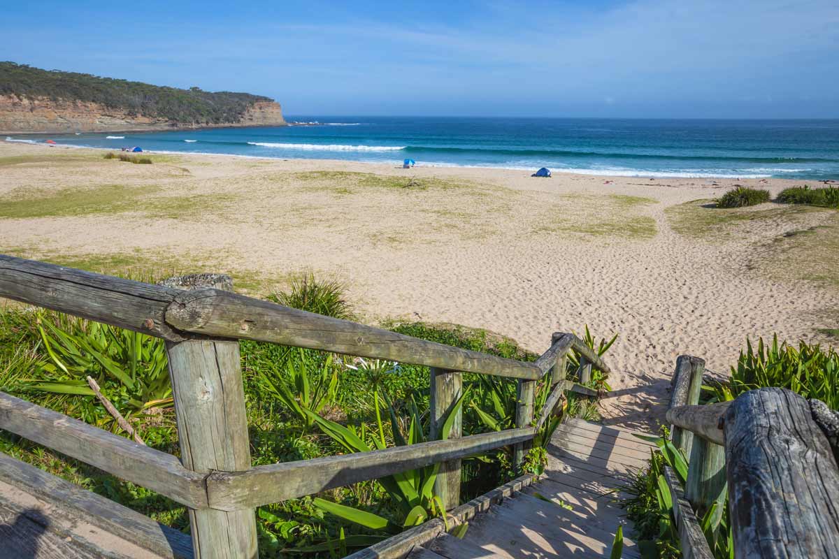
The trail winds past secluded bays, across dramatic rock platforms, and through rare coastal spotted gum forests. Throughout the journey, breathtaking clifftop views of the ocean will keep you company. Expect encounters with diverse wildlife, including eastern grey kangaroos, whales, white-breasted sea eagles, echidnas, and lace monitors.
A unique feature of the walk is the majestic spotted gum and burrawang forest fringing the beaches – a rarity in Australia. These spotted gum trees are easily identified by their smooth, dimpled bark that sheds in summer, revealing a mottled cream and grey “spotted” appearance.
The Murramarang South Coast Walk traverses from Pretty Beach in the north to Maloney’s Beach in the south. The route utilizes both newly built and existing trails. Some existing sections have been upgraded with improved signage, sandstone steps, and short boardwalk sections.
The walk itself is free, and you can choose how you experience it. Guided options with camping or cabin accommodation packages are available through the NSW National Parks website. These packages vary in cost and inclusions depending on the season and your preferences (welcome tours, transfers).
Alternatively, you can choose your own accommodation or hike the trail in sections. If opting for the latter, be prepared to arrange your own transportation between segments. Luckily, the trail stays within 50 kilometres of Batemans Bay, so taxis or similar services are readily available.

Hiking in Australia: Essential tips
Before venturing onto Australia’s trails, ensure you choose a region and track that aligns with your experience and preparation. Check with local authorities and national park websites for the latest weather and track conditions, as these can significantly impact your hike. Always inform someone of your itinerary, including your planned return time.
Respect the Environment:
Australia’s natural beauty is the result of careful management by its Traditional Custodians for millennia. Help preserve it by following these guidelines:
- Leave no trace: Pack out all rubbish. Burying it encourages erosion and attracts animals who may be injured or poisoned by it.
- Toilets: If no toilet facilities are available, bury your waste (including biodegradable toilet paper, but not sanitary products) at least 100 meters from any watercourse. Dig a small, 15-centimeter-deep hole and cover it with soil and a rock. In snowy conditions, dig down to the soil.
- Hygiene near water: Avoid using detergents or toothpaste near watercourses. Spit toothpaste at least 50 meters away from rivers.
- Washing: Use biodegradable soap and a separate water container away from waterways for personal washing. Disperse wastewater widely for natural filtration.
- Campfire safety: Campfires are often banned on Australian trails for parts of the year. Consider a lightweight, portable stove for multi-day hikes, and always adhere to local fire regulations.
Wildlife Encounters:
- Do not feed wildlife. This disrupts natural populations, can make animals dependent on humans, and may spread diseases.
- Leave nature undisturbed: Avoid taking rocks, seed pods, or other souvenirs from the trail.
Preparation and Responsibility:
- Permits and fees: Pay track fees and obtain permits where required, as these funds often support essential services and maintenance.
- Be prepared: Pack sufficient food, water, and appropriate gear (including a first-aid kit) for your hike. Know how to use all your equipment.
- Sun and insect protection: Opt for long, lightweight clothing to shield yourself from the sun and insects.
Trail Etiquette:
- Stay on track: Avoid shortcuts, as they can worsen trail conditions. If you encounter a muddy section, walk straight through to minimize damage.
- Snake safety: Make noise while walking to deter snakes, which are common on Australian trails. If you see a snake, stay calm and assess the situation before moving away slowly.

Ready to hike Australia’s most stunning multi-day trails?
Australia’s diverse landscapes offer some of the world’s most captivating multi-day hikes, each providing a unique window into the country’s natural beauty. From the dramatic clifftops of the Three Capes Track in Tasmania to the remote splendor of the Larapinta Trail in the Northern Territory, these trails invite hikers to explore Australia’s varied terrain, from verdant rainforests and alpine moors to rugged deserts and serene coastlines.
Whether you’re drawn to the untouched wilderness of the Overland Track or the coastal charm of the Cape-to-Cape Track, each hike promises an immersive experience that blends physical challenge with the reward of stunning vistas and profound natural encounters. For those seeking a more extended adventure, the Heysen Trail and Bibbulmun Track offer epic journeys through some of Australia’s most diverse landscapes, while shorter but equally rewarding treks like the Great Ocean Walk and Kangaroo Island Wilderness Trail provide a taste of the country’s incredible natural wealth.
Embarking on any of these multi-day hikes not only allows you to connect deeply with Australia’s wilderness but also offers a chance to challenge yourself and discover the country’s hidden gems. As you plan your next adventure, consider which trail speaks to your sense of exploration and wonder. How many of these remarkable trails will you conquer? The answer to that will shape your journey and your memories, offering a lifetime of stories to tell and stunning landscapes to recall. So lace up your hiking boots, pack your gear, and get ready to experience the magic of Australia’s most breathtaking multi-day hikes.


