Victoria, Australia’s second-smallest state really packs a punch when it comes to strapping on your boots and hitting the trail. Rewards are both diverse and plentiful for the increasing number of outdoor enthusiast seeking to experience Victoria on foot. Discover spectacular coastal walks, remote beaches, towering cliffs, lush rain-forests, pristine waterfalls, historic villages, gold fields, lava tubes, volcanic plains, ancient Devonian reefs and breathtaking views across the vast alpine wilderness. The list goes on.
What I love about hiking in Victoria is that all of this is right on our doorstep, just waiting to be explored. There are trails for kids, for families, for those new to hiking to the more experienced trail blazer. And for the true adventurer there is so much undiscovered wilderness in our Alpine Parks that you could lose yourself for months on end. From a young age I have always loved exploring outdoors but it wasn’t until more recent years that I truly began to appreciate just how lucky I was to be living in a state that had so much to offer.
With in excess of 220 trails now on my site I am often asked which my all-time favourites are. You would think that the answer to the question requires considerable deliberation but I am astounded every time that the following always spring to mind as…
My top 5 hikes in Victoria
The Viking Circuit (40.7km)
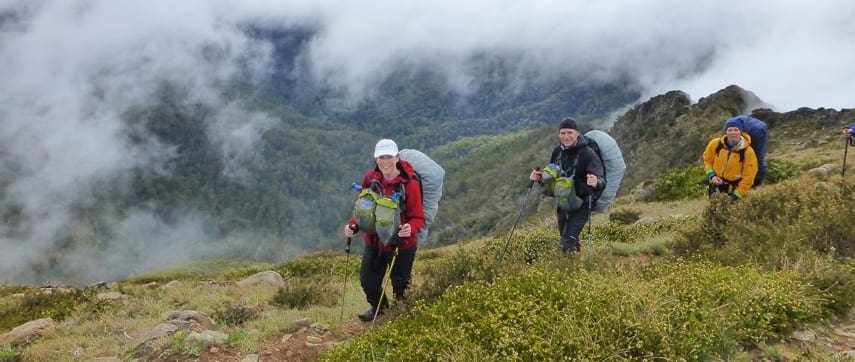
The Alpine National Park stretches from central Gippsland all the way to the New South Wales border where it adjoins Kosciuszko National Park. Within the park are some of Australia’s most stunning alpine landscapes, including mountain peaks, escarpments and grassy high plains. The Viking Circuit will take you deep into the heart of the The Razor – Viking Wilderness, a large area of remote rugged undisturbed land. There is no vehicle access into or within the Razor – Viking Wilderness. Likewise, there are no signposts or walking track markers. Here you will need to be well equipped, self-reliant and experienced in navigation; and prepared to meet nature on its own terms. A portion of this hike traverses a section of the Australian Alps Walking Track, a long distance walking trail through the alpine areas of Victoria, New South Wales and ACT. So for those of you contemplating trekking along the AAWT this will give you a true taste of what’s instore. With some inviting features such as The Crosscut Saw, Mt Buggary, Horrible gap, Mount Despair and The Viking this is not an easy hike. Over 4 days you will cover close to 40km in distance which includes approximately 2,700m of accumulated vertical ascent. Oh yeah, and all that with a full pack.
Cathedral Range – Southern Circuit (11km)
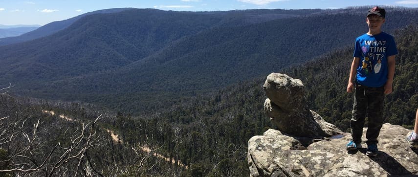
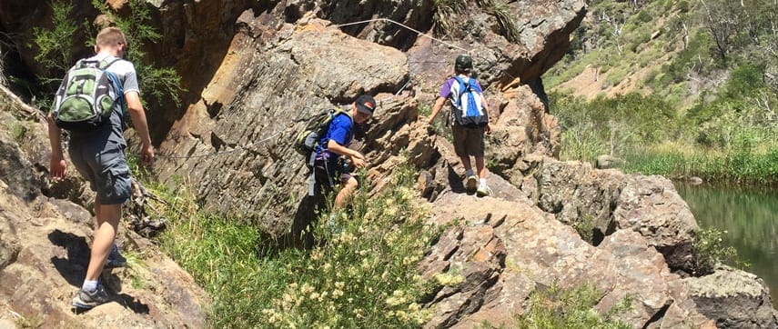
The Cathedral Range is a spectacular range that is part of the Great Dividing Range in Victoria, located in Cathedral Range State Park. The eastern side of the State Park borders onto the Cerberean Caldera, formed by a volcanic eruption approximately 374 million years ago. The range is formed by a spectacular seven kilometre ridge of sharply upturned sedimentary rock, consisting mainly of sandstone, mudstone and conglomerates of the Devonian Period. This has given the range its steep sides, and a narrow razorback ridge. There are a number of walking tracks leading to all the major features of the park. These vary in difficulty from an easy stroll around the Friends Nature Trail to the more challenging, steep and exposed Ridge Track. This hike explores the southern section of the range, taking in some fascinating features such as Wells Cave, The Canyon, Sugarloaf Peak, The Razorback, The Farmyard and South Jawbone. This is a hike for those with a sense of adventure as it involves a serious amount of unassisted rock scrambling along exposed ledges and steep rocky outcrops as you make your way up to Sugarloaf Peak and along the aptly named Razorback Track.
Wilsons Promontory – South Eastern Circuit (54.4km)
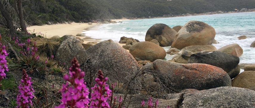
The Wilsons Promontory National Park, locally referred to as Wilsons Prom or The Prom, is a national park in the Gippsland region of Victoria, Australia, located approximately 157 kilometres southeast of Melbourne. The 50,500-hectare (125,000-acre) national park is the southernmost national park on mainland Australia, known for its rainforests, beaches and abundant wildlife. The national park covers the southern portion of Wilsons Promontory, a peninsula containing South Point, the southernmost point on the Australian mainland. The Prom is rich in history with Indigenous Australians occupying the area at least 6,500 years ago based on archaeological records. The first Europeans to sight Wilsons Promontory are believed to be George Bass and Matthew Flinders in 1798. Following European settlement The Prom was used for extensive sealing at Sealer’s Cove during the 19th Century and as a commando training ground during World War II. A memorial to commandos who lost their lives in World War II is located at Tidal River. The famed South Eastern Circuit, weaves its way from the slopes of Mount Oberon down to the eastern shore of Wilsons Promontory National Park at Sealers Cove, where it traverses south above the dramatic waters of Bass Strait to the southernmost lighthouse on mainland Australia which has operated continuously since 1859. From the dramatically-positioned lighthouse, the trail takes you north through the heart of the park, before returning to Tidal River via spectacular Oberon Bay. Along the way, the trail takes hikers through verdant rainforest, across stunning beaches, wide heathlands and stands of thick coastal tea-tree, while secluded campsites offer beautiful vistas and bays with cerulean waters to swim in.
Stapylton Ampitheatre (6.5Km)
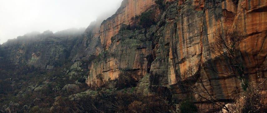
The Grampians National Park, commonly referred to as The Grampians, is a national park located in the Grampians region of Victoria. The 167,219-hectare (413,210-acre) national park is situated between Stawell and Horsham on the Western Highway and Dunkeld on the Glenelg Highway. Proclaimed as a national park on 1 July 1984, the park was listed on the Australian National Heritage List on 15 December 2006 for its outstanding natural beauty and being one of the richest indigenous rock art sites in south-eastern Australia. The Grampians feature a striking series of sandstone mountain ranges formed by a series of low-angled sandstone ridges running roughly north-south. The eastern sides of the ridges, where the sedimentary layers have faulted, are steep and spectacular, beyond the vertical in places – notably at Hollow Mountain near Dadswells Bridge at the northern end of the ranges. This hike, suitable for fit and energetic walkers, can involve water crossings, slippery track surfaces, rock hopping and rock scrambling and unassisted climbing through the wind scoured caverns of Echo Block. Along the way you will enjoy splendid vistas of iron-stained cliffs, rocky outcrops, densely vegetated gullies, woodland of banksias, grass-trees, native pines, eucalypts and the impressively natural Stapylton amphitheatre. The narrow ridge linking Hollow Mountain with Mt Stapylton Ampitheatre is undoubtedly one of the most spectacular regions in Victoria.
Werribee Gorge Scenic Rim (13.7km)
Werribee Gorge State Park is a state park in Victoria, only about one hours drive West of Melbourne. The park is a hidden gem, located near Bacchus Marsh and is popular with hikers and rock climbers, all attracted to its spectacular views and significant geological features. The main feature of this park is the Werribee Gorge, through which the Werribee River twists and turns. Werribee Gorge has attracted the attention of geologists as one of the earliest known ancient glacial deposits. The rugged 200m deep gorge was formed about a million years ago when movements along a fault in the Earth’s crust steepened the river’s gradient. Since then the stream has continued to deepen the gorge through underlying rock to ancient sediments deposited in a sea more than 400 million years ago. Other geological events that have since occurred include the advance and retreat of an ice sheet and the inflow of volcanic lava. There are a number of spectacular walks located within the park, all with amazing vantage points overlooking the river gorge. The Scenic Rim is a demanding hike that showcases many of the parks natural features, most scenic viewpoints and often unexplored regions of the park. Part of this hike follows existing trails with sections being completely off-trail for that added sense of adventure. This is one of the most scenic gorge walks close to Melbourne. It is certainly one of Melbourne’s greatest ‘treasures’.
Author: Darren Edwards – Trail Hiking Australia


Hey mate. I have done these hikes that you mentioned in the article. Such an amazing trip mate, appreciate a lot. I am so into rock scrambling style circuit route and a bit of exposure would be better just like the Stapylton Amphithreate and Southern Circuit track. Is there any similar challenging hikes suggestions?
Hey Chuck, great to hear. A good area for rock scrambling would be the Cathedral Ranges. heaps of fun scrambling there. https://www.trailhiking.com.au/cathedral-range-southern-circuit/
if only i could move to Victoria
Being a born Sydneysider I am however one who spent much time in Victoria and I agree, due to its natural resources and small geographic size it has real advantages. .I plan to avail myself of what Victoria has to offer…call it part of my bucket list ?
These are amazing hikes that me and my oartner have completed as well and would agree that they are some of Victoria’s best
Stede Nyland
Marvin Zumkley
Sarah Keyt
Jessica Haden Ej Pham
Natalie Bartolo youre gonna have to swap the heels for runners
Louise Child pick one
Quiny Whitehead
I always take a booth with me too – in case I need to change into my Superman outfit & fly over the steep bits….
?
Hi Darren
You do a great service to bushwalking in Victoria. Keep up the good work. Hope you get the rewards you deserve.
Cheers
Ian Mair
Thank you Ian. Really appreciate you saying so.