Trail Fast Facts
Cape Pallarenda Many Peaks Track is a 6.2km, grade 4 hike in Cape Pallarenda Conservation Park, Queensland. This hike typically takes 3 hours to complete.
Hike Overview
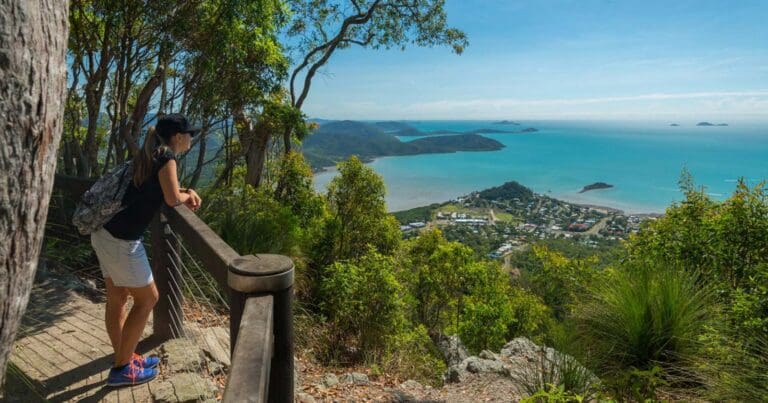
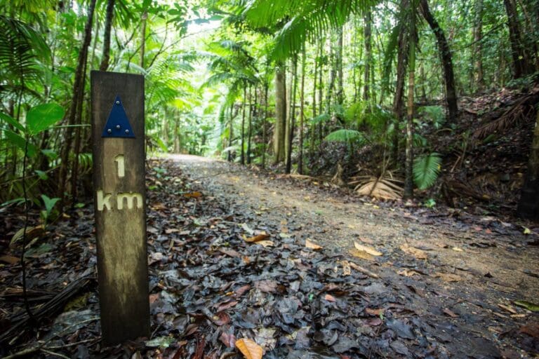
Starting at the western end, or 450 m along the eastern end of the Lagoon Trail, this challenging walk across Many Peaks Range leads to the summit of Mount Marlow, before descending through vine thickets and woodland towards the wetlands below. The walk has spectacular views over the Town Common wetlands and along the coastline from the Palm Islands in the north to Cape Cleveland in the south. Some sections of the trail are very steep and there are many steps. In some areas the trail can be indistinct and walkers must follow the orange trail markers. Walkers may return on the same trail or via the Lagoon trail.
Track Grade
Grade 4 (Hard) - Challenging Walks for Experienced Walkers: Grade 4 on the AWTGS signifies challenging walking tracks. Bushwalking experience is recommended for these tracks, which may be long, rough, and very steep. Directional signage may be limited, requiring a good sense of navigation. These walks are suited for experienced walkers who are comfortable with steeper inclines, rougher terrain, and potentially longer distances.
Tips
- A car shuffle is required
- Bicycles prohibited
- Download the Cape Pallarenda Trails map
Trail information and photo by Carolyn Cox
Map and GPX file
Max elevation: 202 m
Min elevation: 11 m
Total climbing: 344 m
Total descent: -344 m
Trailhead
Sorry, no records were found. Please adjust your search criteria and try again.
Sorry, unable to load the Maps API.
Getting there
Townsville Town Common Conservation Park is 6 km north of the Townsville city centre. Vehicle access to the park is via the main entrance on the turn-off from Cape Pallarenda Road, near the Rowes Bay Golf Club. The gate at this entrance is open from 6.30 am to 6.30 pm daily.
Vehicles must remain on Freshwater Lagoon road (see map). Driving is not allowed in all other areas.
Walkers and mountain bike riders can also enter the park from the eastern end of the Lagoon trail, off Cape Pallarenda Road, and from the Shelly Cove trail in Cape Pallarenda Conservation Park.
Photo gallery
If you’ve got some great shots from this hike, I’d love to see them! Please upload your .jpg files here to help inspire other hikers and show off the beauty of the trail.
A quick note: Uploading your photos doesn’t mean you lose ownership. You’ll be credited for any photos you share, and you can request to have them removed at any time.
About the region
Known locally as the Town Common, the park is close to the bustling city centre of Townsville and is a great place to enjoy nature and fantastic coastal views.
Visitors can hike across the Many Peaks Range, enjoy expansive island views while riding the Under the Radar or Smedley's trails or take the trail to the beautiful and secluded Shelly Beach.
Deep-water lagoons, seasonal wetlands, coastal woodlands and sheltered beaches bordered by rocky headlands all feature in this park. Mangrove-lined tributaries of the Bohle River meander across the floodplains that fill each year during the wet summer months.
Up to 280 bird species have been recorded in the area. Magpie geese, brolgas and many others gather here to feed and nest, particularly as the wetlands dry out and food sources become concentrated in the remaining lagoons.
Suggest an edit
Spotted a change on this trail? Maybe there are new features, the route has shifted, or the trail is permanently closed. Whatever the update, I’d love your input. Your feedback helps fellow hikers stay informed and ensures that our trail info stays fresh and reliable.
Similar trails nearby
Looking for things to do in Cape Pallarenda Conservation Park or nearby? Try these similar hikes or bushwalks.
Let someone know
Adventure with Confidence: Register Your Trip Plans
Before you hit the trail, take a moment to fill out our trip intentions form. It’s a simple way to share important details about your hike with family or friends. If things don’t go as planned and you’re not back on time, they can easily notify emergency services, helping to ensure a quick response and reducing worry. Enjoy your outdoor adventure knowing that you’ve taken a smart step for your safety.
Gear to consider
What you carry in your pack will depend on the weather, terrain, time of year, type of adventure, and personal preferences. Having trouble deciding what gear’s right for you? My free planning, food and packing checklists provide an introduction to things your could consider (as well as the Ten Essentials) on your day, overnight and multi-day adventures. Customise your kit according to your personal needs, always considering safety first.
Explore Safe
While planning your hike, it’s important to check official government sources for updated information, temporary closures and trail access requirements. Before hitting the trail, check local weather and bushfire advice for planned burns and bushfire warnings and let someone know before you go. Plan ahead and hike safely.


