Trail Fast Facts
Bendleby Ranges Circuit is a 6.4km, grade 4 hike in Bendleby Ranges, South Australia. This hike typically takes 3 hours to complete.
Hike Overview
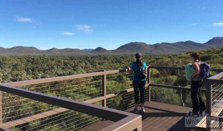
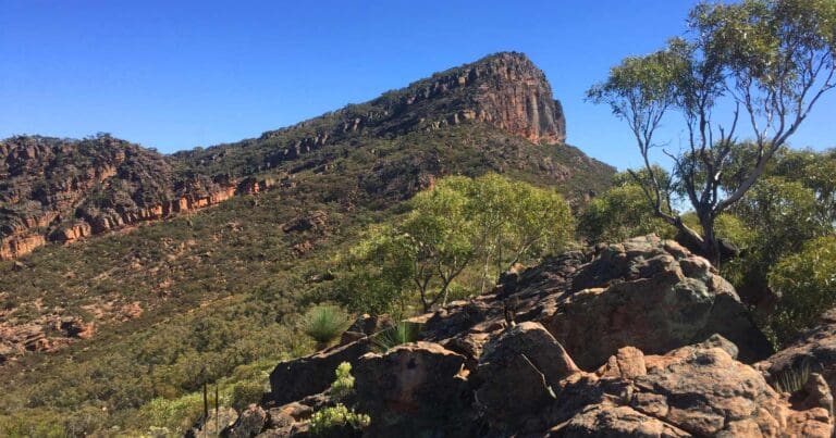
The Bendleby Ranges Circuit is a challenging 6.4-kilometer loop trail in South Australia's Bendleby Ranges. This hike, suitable for experienced bushwalkers with strong navigational skills, takes approximately 3 hours to complete.
The circuit begins at the Rest Area near Solly's Well gate and leads hikers on a scenic journey through Hidden Valley and along the upper creek. It's crucial to note that the trail becomes unmarked after leaving the main creek and requires confident navigation through open country and complex topography.
Following a clockwise direction, the initial section across open country is suitable for experienced walkers. However, after passing a waterfall rock pool and deviating from the main creek, markers disappear entirely. The route then ascends a valley towards a saddle, with only faint tracks that can be easily confused with animal trails.
Due to the lack of markers and the presence of misleading animal tracks, the latter section of the Bendleby Ranges Circuit is best suited for hikers with strong navigational skills and experience in complex terrain.
Track Grade
Grade 4 (Hard) - Challenging Walks for Experienced Walkers: Grade 4 on the AWTGS signifies challenging walking tracks. Bushwalking experience is recommended for these tracks, which may be long, rough, and very steep. Directional signage may be limited, requiring a good sense of navigation. These walks are suited for experienced walkers who are comfortable with steeper inclines, rougher terrain, and potentially longer distances.
Tips
- Stay hydrated and fueled throughout your hike. Carry plenty of water and snacks:
- Apply sunscreen, wear a hat, and consider sun sleeves for prolonged exposure.
- Proper footwear provides stability and support on uneven terrain.
- Temperatures can drop, especially in the mornings and evenings, so pack a jacket or fleece.
- For those not staying overnight at Bendleby Ranges, a property access and map fee of $10 per vehicle applies.
Map and GPX file
Max elevation: 678 m
Min elevation: 500 m
Total climbing: 225 m
Total descent: -224 m
Trailhead
Sorry, no records were found. Please adjust your search criteria and try again.
Sorry, unable to load the Maps API.
Getting there
Bendleby Ranges lies in South Australia's Southern Flinders Ranges, roughly 3.5 hours north of Adelaide by car. The final leg of the journey requires traveling 48 kilometers on a well-maintained dirt road suitable for standard 2WD vehicles.
For those interested in exploring the Hidden Valley walking trails, the starting point is the Rest Area near Solly's Well, accessible by car from the main Bendleby Ranges campground (The Springs) on a mostly 2WD friendly road. However, the last few kilometers might be challenging if not recently graded. In such cases, parking closer and walking the remaining distance is advisable.
Alternatively, you can continue beyond the Rest Area on a 4WD track that bypasses most campsites and leads to the end of the road, offering another access point for a shorter hike into Hidden Valley.
Photo gallery
If you’ve got some great shots from this hike, I’d love to see them! Please upload your .jpg files here to help inspire other hikers and show off the beauty of the trail.
A quick note: Uploading your photos doesn’t mean you lose ownership. You’ll be credited for any photos you share, and you can request to have them removed at any time.
About the region
Located in the Southern Flinders Ranges, Bendleby Ranges is a privately owned station near the township of Orroroo in South Australia. Originally a working sheep station, Bendleby Ranges has expanded its offerings to include tourism since 2000.
Spanning approximately 37,000 acres, the property boasts a rich history. It was once part of the Coonatto and Pekina Pastoral runs, and even the original mail route between Sydney and Perth traversed the land.
Bendleby Ranges offers a unique blend of past, present, and future. Visitors can experience the beauty of the Flinders Ranges by hiking designated trails with stunning vistas or exploring freely with a backpack. The property caters to all camping preferences with a variety of powered and unpowered sites, ranging from secluded bush settings to a large campground with amenities.
Whether you seek remote seclusion, a memorable family getaway, or a luxurious escape, Bendleby Ranges caters to diverse desires. Explore the extensive property on foot using detailed walking maps that offer a range of options, from leisurely strolls to challenging hikes.
Suggest an edit
Spotted a change on this trail? Maybe there are new features, the route has shifted, or the trail is permanently closed. Whatever the update, I’d love your input. Your feedback helps fellow hikers stay informed and ensures that our trail info stays fresh and reliable.
Similar trails nearby
Looking for things to do in Bendleby Ranges or nearby? Try these similar hikes or bushwalks.
Let someone know
Adventure with Confidence: Register Your Trip Plans
Before you hit the trail, take a moment to fill out our trip intentions form. It’s a simple way to share important details about your hike with family or friends. If things don’t go as planned and you’re not back on time, they can easily notify emergency services, helping to ensure a quick response and reducing worry. Enjoy your outdoor adventure knowing that you’ve taken a smart step for your safety.
Gear to consider
What you carry in your pack will depend on the weather, terrain, time of year, type of adventure, and personal preferences. Having trouble deciding what gear’s right for you? My free planning, food and packing checklists provide an introduction to things your could consider (as well as the Ten Essentials) on your day, overnight and multi-day adventures. Customise your kit according to your personal needs, always considering safety first.
Explore Safe
While planning your hike, it’s important to check official government sources for updated information, temporary closures and trail access requirements. Before hitting the trail, check local weather and bushfire advice for planned burns and bushfire warnings and let someone know before you go. Plan ahead and hike safely.
Weather
Acknowledgement of Country
Trail Hiking Australia acknowledges the Traditional Owners of the lands on which we hike and pay respects to their Elders, past and present, and we acknowledge the First Nations people of other communities who may be here today.


