Trail Fast Facts
Catherine River, Speculation and Mount Cobbler is a 42km, grade 5 hike in the Alpine National Park, Victoria. This hike typically takes 4 days to complete.
Warning
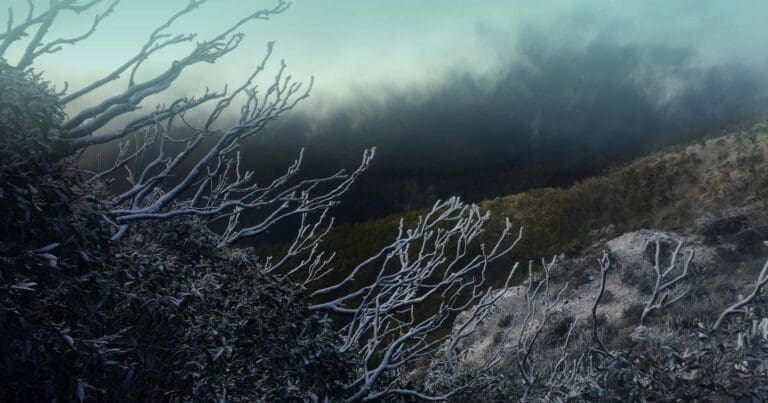
Be prepared for unpredictable weather. Pack for all types of conditions, as the weather can change rapidly in this mountainous region. The Catherine River, Speculation, and Mount Cobbler hike is a demanding one, not suited for all fitness levels. Off-trail navigation skills are essential for this challenging trek.
Hike Overview
Embark on an Epic Alpine Adventure: The Catherine River, Speculation, and Mount Cobbler Circuit
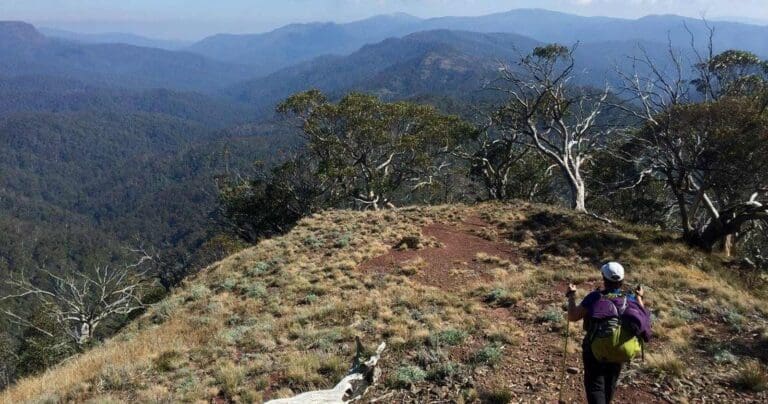
Embark on a captivating four-day hiking journey through the heart of the Victorian Alps, traversing the remote Viking Razor Wilderness Zone. This challenging yet rewarding circuit will take you through breathtaking landscapes, from towering peaks and high-level plateaus to deep, verdant valleys. Discover a hidden section of the Catherine River, complete with a secluded campsite and refreshing swimming hole. Prepare for an adventure that demands fitness, experience, exceptional navigation skills, and a well-equipped backpack to withstand alpine conditions.
Day 1: Speculation Road to Mount Speculation (10 km)
Your adventure begins at the junction of Speculation and King Basin Roads. Cross the bridge and locate the narrow foot trail on the river's southern bank. The trail winds its way southward, then turns southeast, and finally east as it ascends steeply to King Spur. Follow the cliff lines near the ridge's summit until reaching Mount Koonika. From the peak, continue along the southeast ridge, descending to the 4WD track where you'll camp at Mount Speculation.
Day 2: Mount Speculation to Catherine River Campsite (10 km)
Venture into the remote wilderness of the Viking Razor Wilderness Zone, a region rarely explored by hikers. Exceptional navigation skills are essential as you forge your own path. Follow Speculation Road northward from Mount Speculation until reaching a hairpin turn. Continue off-trail along a narrow ridge, heading north. Descend steadily until reaching the Catherine River below. Once at the river, turn right and follow it northward for about 500 meters. Keep an eye out for a suitable campsite amidst the river flats.
Day 3: Catherine River Campsite to Lake Cobbler (10 km)
After breaking camp, embark on a challenging ascent, heading northwest out of the river valley (300 meters). Continue westward along a ridge (another 150 meters) until reaching the plateau's edge. Trek through snow gum forests for approximately 2.5 kilometres to cross the plateau and reach the Lake Cobbler Track. Turn right (east) and follow the track down to Lake Cobbler. Replenish your water supply from the lake and continue westward along the Mount Cobbler Walking Track for about 3 kilometres until you find a flat and open campsite.
Day 4: Lake Cobbler Campsite to Muesli Spur Trailhead (10 km)
From your campsite, continue westward until you reach a signposted trail junction. Turn north (right) for a short, moderate, and steep 1.5 kilometre climb to the summit of Mount Cobbler. Reward yourself with panoramic views of the surrounding peaks, including Mount Typo to the northeast, Mount Koonika and Mount Speculation to the southeast, and Mount Stirling to the southwest.
Descend from the summit and follow the trail back to the junction. Continue southward for approximately 5.5 kilometres until reaching the junction of Little Cobbler Road and the Cobbler Lake Track. Follow Little Cobbler Road southward. After about 700 meters, you'll reach the Speculation Road junction. Continue past Speculation Road and keep heading south for another 450 meters until you reach Muesli Spur Track on your right.
Embark on a final descent along the steep and rugged Muesli Spur to return to the trailhead and your vehicle. Congratulations on completing this epic alpine adventure!
Camping at the trail head
Camping is available close to the trail head at the following locations.
- Speculation Road: There is a small campsite along Speculation Road (possible 4WD) on the King River approximately 3.6km from Stirling Circuit Road.
- King Hut: Camping area on the King River Track (4WD only). King Hut is perched on the western edge of the park, about 35 km east of Mount Stirling. The dramatic 4WD-access route follows the King River Track for 7 km from the junction with Speculation Rd, which is itself reached via a turn-off on Circuit Rd about 6 km east of the Craig's Hut turn-off. The hut itself is in excellent condition, having been recently rebuilt.
Remote Campsites
- Camping is available near the summit of Mount Speculation.
- Near the waterhole at the end of the side gully from Catherine River (not very large) or at the Junction of Catherine River and the side gully (larger and flatter)
- An open saddle near the junction of the Mount Cobbler Walking Track and a foot trail heading north-south at the top of the plateau. This is a large camp site suitable for around 5-6 tents.
Water
Water can be procured;
- Near the trail head from the King River. Water should always be treated before drinking
- North west of Mount Speculation at the head of Camp Creek (off the side of the 4WD track) at the end of day 1.
- From the waterhole at the day 2 campsite. Or anywhere along the Catherine River (if it is flowing) at the end of day 2.
- Lake Cobbler during day 3.
<h2Warning
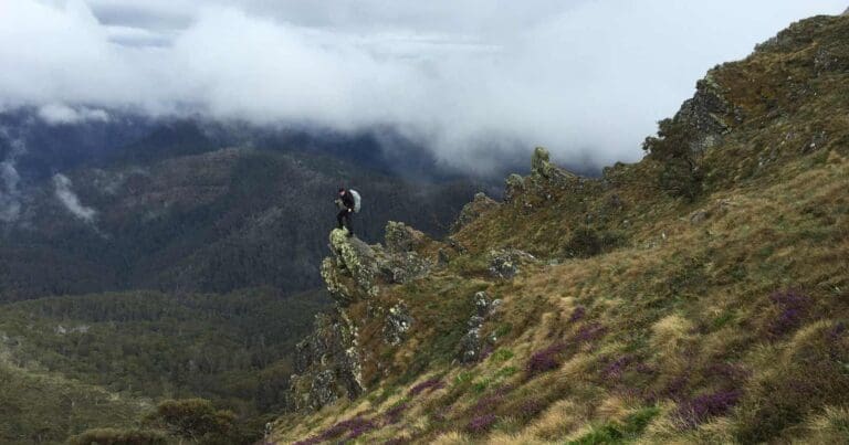
Half of this hike will be off trail through often dense scrub. There will be rock scrambling with packs, possible pack hauling, steep and very steep sections and walking through jagged cliff lines. You will need to be comfortable with all of the above and be a moderate to fast walker while doing so. You will need to work closely as a group and assist with route finding and forging a trail through the scrub.
This is an alpine area and conditions can change quickly. All of your group members must be equipped with map and compass and the appropriate gear.
Map and GPX file
Max elevation: 1652 m
Min elevation: 592 m
Total climbing: 2711 m
Total descent: -2711 m
Trailhead
Sorry, no records were found. Please adjust your search criteria and try again.
Sorry, unable to load the Maps API.
Track Grade
Grade 5 (Difficult) - Walks for the Most Experienced: Grade 5 represents the most challenging walking tracks on the AWTGS. These are only recommended for very experienced and fit walkers with specialised skills, including navigation and emergency first aid. Tracks are likely to be very rough, very steep, and unmarked. Walks may be more than 20 kilometers. These challenging walks demand a high level of fitness and experience to navigate difficult terrain, significant elevation changes, and potentially unformed paths.
Getting there
Driving Directions to the Catherine River, Speculation, and Mount Cobbler Circuit Trailhead
Start your journey from Mansfield and take Mount Buller Road for approximately 32 kilometers. Once you arrive at the toll gate at Mirimbah, pay the entry fee if it's winter. Proceed along Stirling Road for 8 kilometers until you reach Telephone Box Junction (TBJ).
Turn right at TBJ and continue on Stirling Circuit Road for 16.5 kilometers. Speculation Road will be on your right-hand side after this stretch. Take Speculation Road and drive for 8.8 kilometers until you reach the junction of King Basin (4WD) and Speculation Roads. This is the trailhead.
Winter Driving Conditions
During winter, vehicles are not allowed to proceed beyond TBJ. All 2-wheel drives must carry chains when driving to this point.
Summer Driving Conditions
In summer, all vehicles can continue further along The Circuit Road. This gravel road winds through the sub-alpine and alpine forests around Mount Stirling and is accessible for 2-wheel drive vehicles.
Photo gallery
If you’ve got some great shots from this hike, I’d love to see them! Please upload your .jpg files here to help inspire other hikers and show off the beauty of the trail.
A quick note: Uploading your photos doesn’t mean you lose ownership. You’ll be credited for any photos you share, and you can request to have them removed at any time.
About the region
The Alpine National Park is a national park in the Central Highlands and Alpine regions of Victoria, Australia. The 646,000-hectare national park is located northeast of Melbourne. It is the largest National Park in Victoria, and covers much of the higher areas of the Great Dividing Range in Victoria, including Victoria's highest point, Mount Bogong at 1,986 metres and the associated subalpine woodland and grassland of the Bogong High Plains. The park's north-eastern boundary is along the border with New South Wales, where it abuts the Kosciuszko National Park.
Lake Cobbler
Lake Cobbler is a beautiful lake situated on the south eastern edge of the Alpine National Park. Lake Cobbler was created in the 1960s by damming a swamp area in the headwaters of the Dandongadale River. After leaving the lake, Dandongadale River plunges over a precipice, creating the longest drop waterfall in Victoria (a heady 255m). It then joins the Rose River, which flows into the Buffalo River, before settling down to a quiet life in the backwaters of Lake Buffalo.
Suggest an edit
Spotted a change on this trail? Maybe there are new features, the route has shifted, or the trail is permanently closed. Whatever the update, I’d love your input. Your feedback helps fellow hikers stay informed and ensures that our trail info stays fresh and reliable.
Similar trails nearby
Looking for things to do in Alpine National Park or nearby? Try these similar hikes or bushwalks.
Let someone know
Adventure with Confidence: Register Your Trip Plans
Before you hit the trail, take a moment to fill out our trip intentions form. It’s a simple way to share important details about your hike with family or friends. If things don’t go as planned and you’re not back on time, they can easily notify emergency services, helping to ensure a quick response and reducing worry. Enjoy your outdoor adventure knowing that you’ve taken a smart step for your safety.
Gear to consider
What you carry in your pack will depend on the weather, terrain, time of year, type of adventure, and personal preferences. Having trouble deciding what gear’s right for you? My free planning, food and packing checklists provide an introduction to things your could consider (as well as the Ten Essentials) on your day, overnight and multi-day adventures. Customise your kit according to your personal needs, always considering safety first.
Explore Safe
While planning your hike, it’s important to check official government sources for updated information, temporary closures and trail access requirements. Before hitting the trail, check local weather and bushfire advice for planned burns and bushfire warnings and let someone know before you go. Plan ahead and hike safely.
Weather
Acknowledgement of Country
Trail Hiking Australia acknowledges the Traditional Owners of the lands on which we hike and pay respects to their Elders, past and present, and we acknowledge the First Nations people of other communities who may be here today.


