Trail Fast Facts
Howitt and Helicopter Spur is a challenging 27km, grade 5 hike in Alpine National Park, Victoria. This hike typically takes 2 days to complete.
Warning
This is a challenging grade 5 hike in a remove and rugged area. Trails may be ill-defined, the terrain will be steep and challenging with multiple rock scrambles required. This hike is for experiences, self-reliant hikers with excellent navigation skills.
Hike Overview
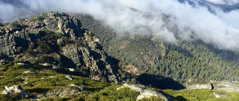
This spectacular Howitt and Helicopter Spur alpine hike visits both Mount Magdala and Mount Howitt traversing one of the best sections of the long-distance Australian Alps Walking Track. Helicopter Spur, the route used to reach the tree line, is one of the steepest and most challenging climbs in the region. Except for Helicopter Spur this walk follows generally good walking trails and offers magnificent views across the heart of the Victorian Alps.
Day 1 (10km): Upper Howqua Campsite to Hellfire Creek Campsite
The ascent of Helicopter Spur starts at the Upper Howqua Campsite and winds through eucalyptus forests, eventually reaching the high alpine plains. Look for the old fire vehicle track starting on your right as you cross the bridge into the campground. The trail soon narrows into a single track, potentially overgrown with young eucalyptus trees and fallen logs, but still manageable.
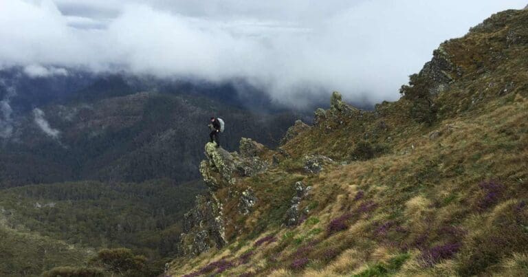
After a few kilometers of ascent, you'll encounter a daunting section of rock faces that seem to block the path. Fear not, that's exactly where the track goes! The route up these rocks is steep but well-defined. Take your time and prioritize safety, as a fall could lead to serious injury. However, for those who enjoy a bit of a challenge, this section can be the exciting start of an unforgettable adventure.
After finally reaching the top of Helicopter Spur, turn east (left) at the 4WD track then follow the trail for approximately 2 kilometers. This section leads to a well-known long-distance route in the area, the Australian Alps Walking Track (AAWT). The route takes you past Picture Point, the scenic summit of Mount Magdala, past the every popular Hells Window and down to the shaded Hellfire Creek campground.
Water is plentiful at the start point of this hike but it is essential that you carry enough ( I recommend 3-4 litres) to last through to the overnight camp at Hellfire Creek. Finding water at Hellfire creek can be hit and miss as it is not a permanent spring. Last time I completed this hike, I had to dig around for water so its advisable to plan for this and maybe carry enough for both days. While it's recommended to carry enough water for the entire journey, there might be streams along the way for refilling.
Day 2 (17km): Hellfire Creek Campsite to Upper Howqua Campsite
Day two commences with an enjoyable climb from Hellfire Creek Campsite, over Big Hill before the final ascent to the open summit of Mt Howitt. You will then traverse the early sections of the infamous Cross Cut Saw before descending along Stanleys Name Spur and Queens Spur Road and lower section of the Howqua Feeder Track.
You will need to carry enough water (I recommend 4 litres), although the final few km are along the Howqua River.
Track Grade
Grade 5 (Difficult) - Walks for the Most Experienced: Grade 5 represents the most challenging walking tracks on the AWTGS. These are only recommended for very experienced and fit walkers with specialised skills, including navigation and emergency first aid. Tracks are likely to be very rough, very steep, and unmarked. Walks may be more than 20 kilometers. These challenging walks demand a high level of fitness and experience to navigate difficult terrain, significant elevation changes, and potentially unformed paths.
Tips
Be Prepared: This hike requires that you have a sufficient level of equipment (in good working order), fitness and self-reliance. It is vital that you take personal responsibility for ensuring you are prepared! If you are not sure, contact the hike leader prior to the hike.
Warning: This is a challenging hike that should not be underestimated. Helicopter Spur is steep and rocky requiring exposed scrambling in places. Some people may find that ropes will be useful. Some navigational experience is required.
Map and GPX file
Max elevation: 1734 m
Min elevation: 840 m
Total climbing: 1711 m
Total descent: -1711 m
Trailhead
Sorry, no records were found. Please adjust your search criteria and try again.
Sorry, unable to load the Maps API.
Getting there
From Mansfield follow the Mount Buller Road for 32km to Mirimbah. Turn left and continue up the Mount Stirling Road for 9km to Telephone Box Junction. Keep right on Circuit Road and continue over Howqua Gap to the Bindaree turnoff (60km from Mansfield). Follow Bindaree Road down to the Howqua Valley. Turn left and after 200m you will arrive at the Upper Howqua Camping Area.
About the region
The Alpine National Park is a national park in the Central Highlands and Alpine regions of Victoria, Australia. The 646,000-hectare national park is located northeast of Melbourne. It is the largest National Park in Victoria, and covers much of the higher areas of the Great Dividing Range in Victoria, including Victoria's highest point, Mount Bogong at 1,986 metres and the associated subalpine woodland and grassland of the Bogong High Plains. The park's north-eastern boundary is along the border with New South Wales, where it abuts the Kosciuszko National Park.
Suggest an edit
Spotted a change on this trail? Maybe there are new features, the route has shifted, or the trail is permanently closed. Whatever the update, I’d love your input. Your feedback helps fellow hikers stay informed and ensures that our trail info stays fresh and reliable.
Similar trails nearby
Looking for things to do in Alpine National Park or nearby? Try these similar hikes or bushwalks.
Let someone know
Adventure with Confidence: Register Your Trip Plans
Before you hit the trail, take a moment to fill out our trip intentions form. It’s a simple way to share important details about your hike with family or friends. If things don’t go as planned and you’re not back on time, they can easily notify emergency services, helping to ensure a quick response and reducing worry. Enjoy your outdoor adventure knowing that you’ve taken a smart step for your safety.
Gear to consider
What you carry in your pack will depend on the weather, terrain, time of year, type of adventure, and personal preferences. Having trouble deciding what gear’s right for you? My free planning, food and packing checklists provide an introduction to things your could consider (as well as the Ten Essentials) on your day, overnight and multi-day adventures. Customise your kit according to your personal needs, always considering safety first.
Explore Safe
While planning your hike, it’s important to check official government sources for updated information, temporary closures and trail access requirements. Before hitting the trail, check local weather and bushfire advice for planned burns and bushfire warnings and let someone know before you go. Plan ahead and hike safely.
Weather
Acknowledgement of Country
Trail Hiking Australia acknowledges the Traditional Owners of the lands on which we hike and pay respects to their Elders, past and present, and we acknowledge the First Nations people of other communities who may be here today.


2 Reviews on “Howitt & Helicopter Spur Hike (27km)”
March 2024:
– Fun trail, with amazing views on the ridges.
– Please don’t assume there’ll be water at Hellfire. Was dry, so we carried up 6+L.
– Tricky going on both days. Steep at high altitude, overgrown at lower altitude (esp. on Stanley’s Name spur). Navigation was OK enough but would be tricky at night in the scrub sections.
– Some scrambling required. Fine to do with pack on.
– Very cheeky foxes (I think) at Hellfire camp. Tried to steal my backpack, and even nicked a foam mat from under my closed vestibule. No fear at all sniffing centimetres from my head though my tent. Hang up your food folks.
Sounds like you had a fun trip. I love this hike and your comments brought back great memories. Good tips about Hellfire as it often runs dry. Sneaky little foxes, that’s certainly something to be mindful of. That’d suck if your pack was stolen.
Did this over the 22/23 New Year with a group of four. Trail is in great condition and was great fun. Bushwalking Vic have done work on Queens Spur to clear it between the Howqua River and Stanley Name Spur (although the blackberries are coming back fast – always a problem in that valley). You may have seen some news reporting of a hiker having trouble at the HellFire Creek/Mount Magdala Campsite. There is definitely a confident animal of some sort hanging around that site. Tore open one of our tents and dragged items all over the place. Dragged a pack from underneath a vestibule. We saw a pair of beedy eyes in the dark, but didn’t see what it was. Its strong though, perhaps a big possum or even a wily wild dog/Alpine Dingo. Unsure, but keep your gear packed properly in case.
What a great way to spend New Years. Great tip on the ‘thief in the night’.
Mani Andreetta
Lynda Maddison thx, looks tough and amazing. I’ve wanted to do Mt, Howitt, the Crosscut Saw and Bluff track for such a long time.
Trail Hiking Australia how hard is helicopter spur?
Dean Herman it’s steep and seemingly relentless but honestly, not too bad. There’s one section where you approach what seems like an impassable rock face but with a bit of investigation, it’s easy enough to find a way to climb/scramble up.
Love it!! My first hike when I started hiking – down track was very overgrown with blackberries last I did it
Nina Birss
Jason Goldstein
In One day ?
We did Viking fast 🤷🏻♂️
( and not a single meltdown😂)
Michael Wilson more of a moment than a meltdown…
Love this hike. An excellent challenge.
This is one of my alpine favourites. A sensational hike.
we should