Trail Fast Facts
Mount Solitary Walking Track is a 34km, grade 5 hike in Blue Mountains National Park, New South Wales. This hike typically takes 3 days to complete.
Warning
The walking track is a remote location, so please ensure you're well-prepared, bring appropriate clothing and equipment and advise a family member or friend of your travel plans. This walk is only suitable for experienced bushwalkers who are comfortable and self-reliant with backcountry hiking and camping.
Hike Overview
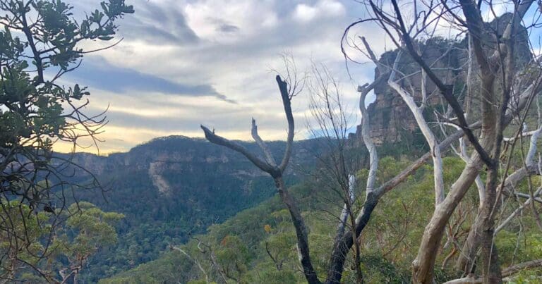
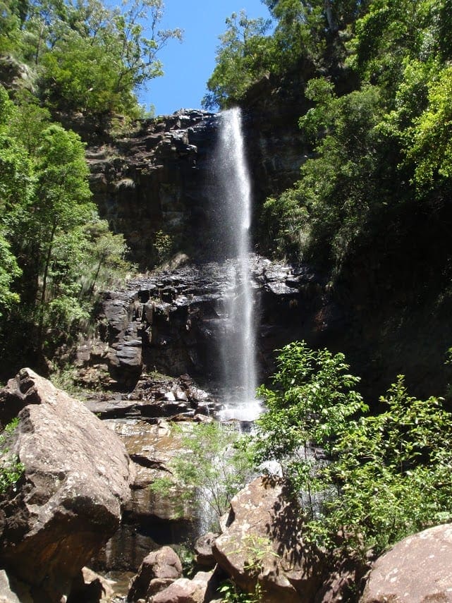
Take a challenging, multi-day hike over Mount Solitary in Blue Mountains National Park. Enjoy scenic mountain views, historic heritage, and bush camping, starting out from Katoomba. For a chance to go wild for 3 days, pack your hiking boots and essential gear and head for the Mount Solitary Walking Track. A challenging track to enchant experienced bushwalkers, it passes through cool temperate rainforest, mountain heath, and tall Eucapytus forest.
Starting at Scenic World, descend Furber Steps to Federal Pass and walk the track where a horse-drawn tramway once ran.
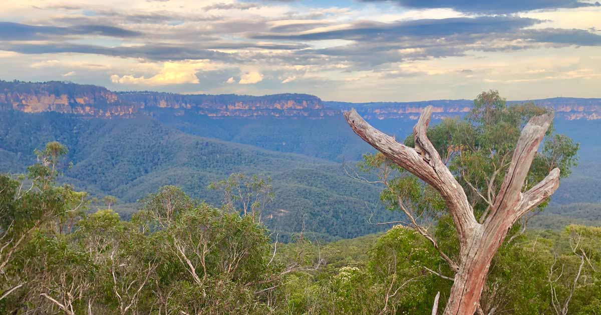
Day 1 takes you on a 7km hike through a wonderland of rocky terrain, emerald tree ferns and towering mountain blue gums. After roughly 4.5 hours, you'll reach Ruined Castle campground, where you can pitch your tent among the fascinating remnants of an 1882 mining operation. Take a short walk to the iconic rock formation nicknamed "Ruined Castle" and soak in the sunset's magic. Watch as deep shadows creep across the cliffs and paint the Jamison Valley in a stunning twilight palette.
Tips for day 1: The Ruined Castle campground has a drop toilet, water tanks, picnic tables and shelter. As this was a short day and we were't certain about the reliability of water, we carried enough water to get us through days 1 and 2.
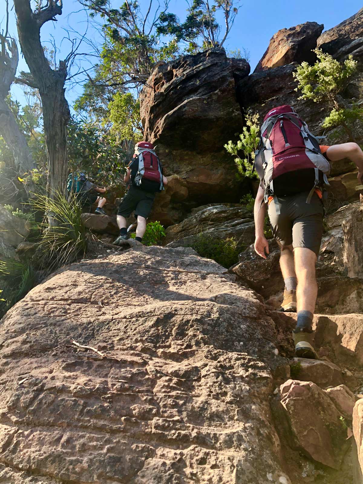
Day 2 is the hardest and you'll need 8hrs to cover 9km of difficult terrain. Get the heart pumping with a hike up Koorowall Knife Edge along a rough unformed track on the western ridge of Mount Solitary. This unformed track along the mountain's western ridge is no walk in the park, but the payoff is epic. Prepare for adrenaline-pumping moments as you navigate the rocky terrain and soak in the panoramic views.
When you reach Chinamans Gully via a short detour you'll be rewarded with spectacular views and wedge-tailed eagles surfing the valley thermals. Bask in spellbinding views across Jamison Valley. To the south, spot the rugged ravines of the Wild Dog mountains and the unspoilt Kanangra-Boyd wilderness. Take a moment to admire the hardy mountain heath, old man bankias, and scribbly gums while listening for the call of peregrine falcons.
The final leg takes you across the top and down the steep eastern slope of Mount Solitary to Kedumba River. This is s steep and long descent along rocky and slippery terrain so careful navigation is needed. Embrace the challenge and savor the feeling of accomplishment as you reach your campsite. Remember to treat the water from the Kedumba River before drinking, and keep your ears tuned for the enchanting calls of lyrebirds, possums, and owls as you settle in for a night under the stars.
Tips for day 2: The Koorowall Knife Edge is steep and challenging but is well marked with directional markers on the rocks. Once on the Solitary plateau, there is no reliable water source but you may be able to locate some in the headwaters of various gullies. The Kedumba River offers a reliable water source but should be treated before drinking.
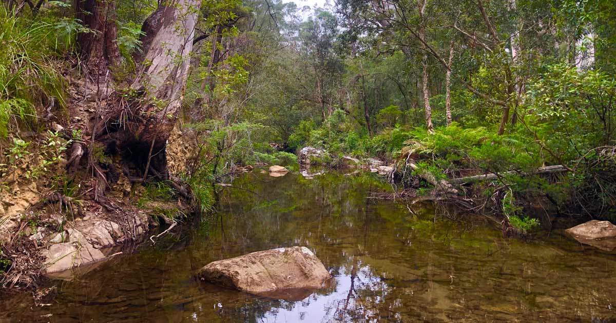
Day 3 and the final day involves a 14km walk. From Kedumba River you'll continue to follow Mount Solitary walking trail for 2km as it steeply ascends to the Sublime Point fire trail. When you meet the fire trail, follow it to the west, passing Jamison and Leura Falls Creeks. Wander through Leura forest and into the rainforest gully known as Fern Bower. Look out for the splash of red waratah flowers amid the grey forest gums if you happen to be here in spring. Finally, ascend the Three Sisters to Echo Point via the Giant Stairway then follow the Prince Henry Cliff Walk back to Scenic World. If you opt to follow Federal Pass to the west, rather than ascending the Giant Stairway, you'll finish back at the base of Furber Steps where you started.
Tips for day 3: Most of this day follows the Sublime Point fire trail so is not as 'remote' as the previous days. It is a long day with a lot of ascent, especially at the end when you will either climb the Furber Steps (951 steps) or the Giant Stairway (998 steps).
Tips
It's a good idea to visit the Katoomba Police station and complete a trip intention form before you start this 3-day walk. You can hire a Personal Locator Beacon (PLB) from the Blackheath National Parks Heritage Centre. Bring a topographic map, compass, GPS or other electronic navigation system. Maps and trail guides can be purchased from Blue Mountains Heritage Centre at Blackheath or Katoomba visitor centre at Echo Point.
Check for Total Fire Bans before you set out and get the latest track conditions from staff Blue Mountains Heritage Centre on: (02) 4787 8877.
You'll need to treat water from the creeks, waterholes and tanks before drinking. This walk is in the Waragamba catchment for Sydney's drinking water. Don't wash dishes in creeks or rivers. Please walk at least 50m from rivers and creeks before toileting and bury toilet waste at least 15cm deep. Take a bag for rubbish and carry everything out with you.
Toilets only available at Ruined Castle.
Map and GPX file
Max elevation: 966 m
Min elevation: 172 m
Total climbing: 3239 m
Total descent: -3238 m
Trailhead
Sorry, no records were found. Please adjust your search criteria and try again.
Sorry, unable to load the Maps API.
Track Grade
Grade 5 (Difficult) - Walks for the Most Experienced: Grade 5 represents the most challenging walking tracks on the AWTGS. These are only recommended for very experienced and fit walkers with specialised skills, including navigation and emergency first aid. Tracks are likely to be very rough, very steep, and unmarked. Walks may be more than 20 kilometers. These challenging walks demand a high level of fitness and experience to navigate difficult terrain, significant elevation changes, and potentially unformed paths.
Getting there
Mount Solitary walking track is in the Katoomba area of Blue Mountains National Park.
To get there by car: Drive west from Sydney on Great Western Highway to Katoomba. Turn into Katoomba Road and follow signs to Cliff Drive. Park at Scenic World or at Katoomba Kiosk overnight, located near Katoomba Oval on Cliff Drive.
By public transport: Catch the train to Katoomba. From here you can walk to Furber Steps near Katoomba Kiosk and Scenic World, or take the local hop-on hop-off tourist bus down to Katoomba Kiosk on Cliff Drive.
Most facilities are available in Katoomba, Leura, and Wentworth Falls, including accommodation.
About the region
Explore World Heritage-listed Blue Mountains National Park, home of the famous Three Sisters in Katoomba. Discover iconic lookouts and waterfalls, historic walking tracks, mountain biking, Aboriginal culture, adventure sports, and camping - right on Sydney's doorstep.
Katoomba area is the heart of Blue Mountains National Park. This popular day trip from Sydney is home of the iconic Three Sisters. It's packed with heritage walks, world-class views and waterfalls, including Wentworth Falls.
The dazzling natural beauty of Katoomba, Leura and Wentworth Falls has drawn visitors for over 100 years. Echo Point is a Blue Mountains favourite. Marvel at the famous views of the Three Sisters rock formation, Mount Solitary, and the dramatic sandstone cliffs towering above the Jamison Valley.
From family-friendly strolls to challenging descents into World Heritage-listed wilderness, Katoomba area is a walker's paradise. Take in ever changing views along Prince Henry Cliff walk which boasts over 20 lookouts and 3 waterfalls between Katoomba and Leura. Swap cliff top for cool rainforest on the short Round walking track. It's easily combined with a Scenic World ride (fees apply). The historic Giant Stairway will test your legs as it zig zags down the cliff face to meet the heart-pumping Federal Pass.
Suggest an edit
Spotted a change on this trail? Maybe there are new features, the route has shifted, or the trail is permanently closed. Whatever the update, I’d love your input. Your feedback helps fellow hikers stay informed and ensures that our trail info stays fresh and reliable.
Similar trails nearby
Looking for things to do in Blue Mountains National Park or nearby? Try these similar hikes or bushwalks.
Let someone know
Adventure with Confidence: Register Your Trip Plans
Before you hit the trail, take a moment to fill out our trip intentions form. It’s a simple way to share important details about your hike with family or friends. If things don’t go as planned and you’re not back on time, they can easily notify emergency services, helping to ensure a quick response and reducing worry. Enjoy your outdoor adventure knowing that you’ve taken a smart step for your safety.
Gear to consider
What you carry in your pack will depend on the weather, terrain, time of year, type of adventure, and personal preferences. Having trouble deciding what gear’s right for you? My free planning, food and packing checklists provide an introduction to things your could consider (as well as the Ten Essentials) on your day, overnight and multi-day adventures. Customise your kit according to your personal needs, always considering safety first.
Explore Safe
While planning your hike, it’s important to check official government sources for updated information, temporary closures and trail access requirements. Before hitting the trail, check local weather and bushfire advice for planned burns and bushfire warnings and let someone know before you go. Plan ahead and hike safely.
Weather
Acknowledgement of Country
Trail Hiking Australia acknowledges the Traditional Owners of the lands on which we hike and pay respects to their Elders, past and present, and we acknowledge the First Nations people of other communities who may be here today.


