Trail Fast Facts
Mt Bogong Circuit from Falls Creek is a 63km, grade 4 hike in Alpine National Park, Victoria. This hike typically takes 4-5 days to complete.
Hike Overview
The Mt Bogong Circuit begins at Falls Creek, where there is ample parking outside the ski season. This 63 km, grade 4 hike in Victoria's Alpine National Park typically takes 4–5 days to complete.
Stage 1 (25 km): Falls Creek to Bogong Creek Saddle
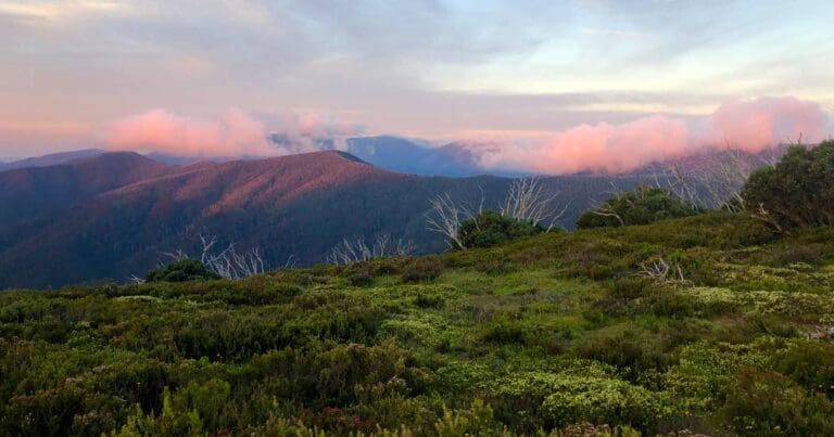
Start by crossing the Rocky Valley Dam wall, then follow the Heathy Spur Track to the Big River Firetrail. The route leads across an undulating, treeless plain, offering easy walking towards Timms Spur. For a stunning view of Mt Bogong, take a short detour up to the ridgeline. After rejoining the Big River Firetrail, the track steadily descends to Big River. After crossing the river, a short but steep climb (about 1 km) brings you to Bogong Creek Saddle. This is a good spot to camp, with a flat, open area and a nearby water source.
Stage 2 (12 km): Bogong Creek Saddle to Cleve Cole Hut (via Mt Bogong)
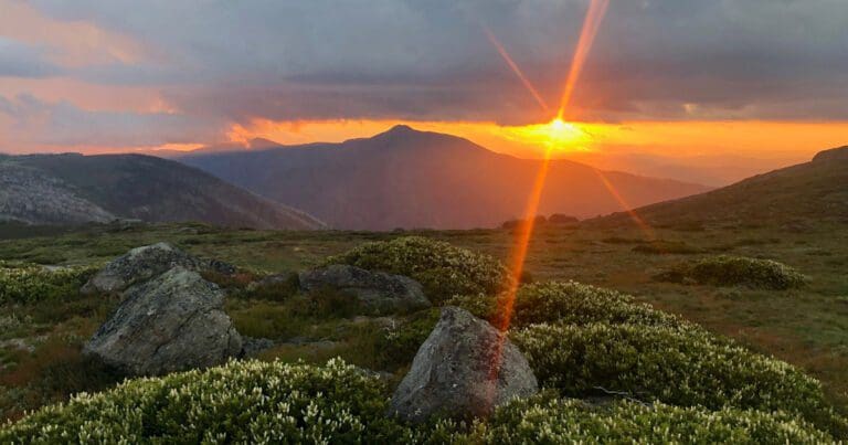
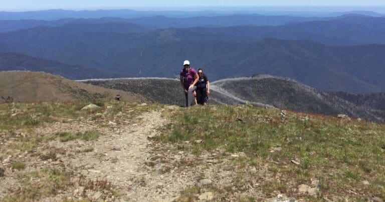
Retrace your steps down the Big River Firetrail for about 500 metres, then take the Quartz Ridge track. This track climbs gradually and eventually rises above the treeline, rewarding you with panoramic views. The summit of Mt Bogong, the highest point in Victoria, comes into sight. After reaching the top and taking in the views, continue towards Camp Valley and set up camp near Cleve Cole Hut, one of the most iconic huts in the High Country.
Stage 3 (12 km): Cleve Cole Hut to Ropers Hut
Head south from Cleve Cole Hut, taking a side trip to Howmans Falls if the weather is warm—it's a great spot for a dip. Returning to the main trail, the track follows the Australian Alps Walking Track (AAWT) and descends sharply to Big River. A chain across the river helps with the crossing, making it a good place for a lunch break. After crossing, the track climbs steeply to Ropers Hut, where there's plenty of space for camping.
Stage 4 (15 km): Ropers Hut to Falls Creek
Continue south along the AAWT, eventually rejoining the Big River Firetrail above the treeline. The final stretch leads back to Falls Creek, where a well-earned coffee (or alternate beverage) awaits.
Alternative Route Option
An alternative route for this circuit starts from the north at Mountain Creek Campsite, ascending via the Staircase and returning along Eskdale Spur. This avoids crossing the plains to Falls Creek but adds a third climb compared to starting from the south, where you gain elevation by driving to Falls Creek.
Tips
- Bring walking poles if you have sensitive knees, as the descents can be tough on joints.
- Use a water bladder for easy access to hydration, as water sources are about 300–500 metres from the recommended campsites.
- Pack plenty of sunscreen, as much of the hike is exposed and lacks tree cover.
- Avoid attempting this hike in winter unless you are highly experienced and equipped with appropriate winter gear.
Map and GPX file
Max elevation: 1985 m
Min elevation: 1033 m
Total climbing: 3206 m
Total descent: -3203 m
Trailhead
Sorry, no records were found. Please adjust your search criteria and try again.
Sorry, unable to load the Maps API.
Track Grade
Grade 4 (Hard) - Challenging Walks for Experienced Walkers: Grade 4 on the AWTGS signifies challenging walking tracks. Bushwalking experience is recommended for these tracks, which may be long, rough, and very steep. Directional signage may be limited, requiring a good sense of navigation. These walks are suited for experienced walkers who are comfortable with steeper inclines, rougher terrain, and potentially longer distances.
Getting there
The hike begins at the Falls Creek car park. From Melbourne, take the Hume Freeway and exit at Wangaratta, then follow the signs to Falls Creek. The drive offers scenic views as you wind your way up to the Alpine National Park.
Photo gallery
If you’ve got some great shots from this hike, I’d love to see them! Please upload your .jpg files here to help inspire other hikers and show off the beauty of the trail.
A quick note: Uploading your photos doesn’t mean you lose ownership. You’ll be credited for any photos you share, and you can request to have them removed at any time.
About the region
The Alpine National Park is a national park in the Central Highlands and Alpine regions of Victoria, Australia. The 646,000-hectare national park is located northeast of Melbourne. It is the largest National Park in Victoria, and covers much of the higher areas of the Great Dividing Range in Victoria, including Victoria's highest point, Mount Bogong at 1,986 metres and the associated subalpine woodland and grassland of the Bogong High Plains. The park's north-eastern boundary is along the border with New South Wales, where it abuts the Kosciuszko National Park.
Suggest an edit
Spotted a change on this trail? Maybe there are new features, the route has shifted, or the trail is permanently closed. Whatever the update, I’d love your input. Your feedback helps fellow hikers stay informed and ensures that our trail info stays fresh and reliable.
Similar trails nearby
Looking for things to do in Alpine National Park or nearby? Try these similar hikes or bushwalks.
Let someone know
Adventure with Confidence: Register Your Trip Plans
Before you hit the trail, take a moment to fill out our trip intentions form. It’s a simple way to share important details about your hike with family or friends. If things don’t go as planned and you’re not back on time, they can easily notify emergency services, helping to ensure a quick response and reducing worry. Enjoy your outdoor adventure knowing that you’ve taken a smart step for your safety.
Gear to consider
What you carry in your pack will depend on the weather, terrain, time of year, type of adventure, and personal preferences. Having trouble deciding what gear’s right for you? My free planning, food and packing checklists provide an introduction to things your could consider (as well as the Ten Essentials) on your day, overnight and multi-day adventures. Customise your kit according to your personal needs, always considering safety first.
Explore Safe
While planning your hike, it’s important to check official government sources for updated information, temporary closures and trail access requirements. Before hitting the trail, check local weather and bushfire advice for planned burns and bushfire warnings and let someone know before you go. Plan ahead and hike safely.
Weather
Acknowledgement of Country
Trail Hiking Australia acknowledges the Traditional Owners of the lands on which we hike and pay respects to their Elders, past and present, and we acknowledge the First Nations people of other communities who may be here today.


1 Review on “Mount Bogong Circuit from Falls Creek Hike (63km)”
Great views but a few issues with the pacing and track itself that would make this extremely difficult in wet/icy conditions.
The first issue is the super long first day, it’s 25km+ (I recorded around 28km with a minor diversion). That is a massive first day with a full pack, and involved a river crossing at the end of the day which was around knee deep when I was hugely fatigued.
The second day is steep but reasonable, there’s limited water on the way up but it’s only around 4-5ks before you get some accessible water off the western slopes and near Bogong summit, rest to cleve is easy.
Third day is where the track is messed up, the decent/ascent is a challenge but there’s a huge number of trees down on both sides, and no water sources I could find other than Big River itself during the crossing. The chains are annoyingly not the lowest point to cross but with the height/speed of the water shorter/smaller people will have to choose between safety and ease of crossing.
The final day is fire trail so easy walking though exposed.
If anything it might be worth doing this in reverse and stopping at Roper’s on day 1, pushing the climb on day 2, and camping the saddle at the end of quartz day 3.
That way the longest day is the lightest packs but also the easiest trail.
Alternatively consider doing the Grey Hills track to Spion and linking back to near Mt Nelsen, this reduces the loop “overlap” and if desired could link another day to the closer huts for a easy final day of 6-8km.