Trail Fast Facts
Passage Peak is a 4.5km, grade 3 hike located on Hamilton Island, Queensland. This hike typically takes 2 hours to complete.
Warning
Walking trails are traversed at the walker's own risk. Please consider weather conditions, your physical fitness and your state of health. Hamilton Island accepts no liability for any injuries sustained.
Hike Overview
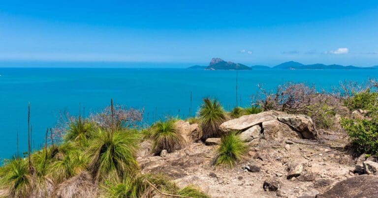
Starting at the Scenic Trail entrance at the east end of Catseye Beach, the Passage Peak walk is spectacular but challenging. This walk will take you through Saddle Junction, from here it's a 900m climb to the top. The stairs which are 150m from the top will have you puffing and asking yourself why you chose to do this walk?! But it will become apparent when you've made it to the top; the reward is an awe-inspiring view of the Whitsundays from the highest vantage point of Hamilton Island.
There are a range of trails available depending on your fitness levels, and how far you want to walk. The route and description described here is one option.
Track Grade
Grade 3 (Moderate) - Walks for Most Fitness Levels: Grade 3 on the AWTGS represents moderate walking tracks. These are ideal for walkers with some fitness who are comfortable with some hills and uneven terrain. While suitable for most ages, some bushwalking experience is recommended to ensure a safe and enjoyable experience. Tracks may have short, steep hill sections, a rough surface, and many steps. The total distance of a Grade 3 walk can be up to 20 kilometers.
Tips
Bush & walking trails are open from 6.30am to 5.30pm. The trails are not staffed and do not get closed off in the evenings.
Most trails are rocky. Sturdy, enclosed footwear with good tread is required.
You can pick up a free copy of the Hamilton Island walking map at the tour desk on the island.
Please note there are no toilets on the walking trails.
Map and GPX file
Max elevation: 196 m
Min elevation: 14 m
Total climbing: 302 m
Total descent: -302 m
Trailhead
Sorry, no records were found. Please adjust your search criteria and try again.
Sorry, unable to load the Maps API.
Getting there
Whether you plan on arriving by plane, helicopter, boat, ferry or a private yacht, there are several hassle-free ways to get to and from Hamilton Island. The only Whitsundays Island with its own commercial airport, Hamilton Island Airport services direct flights from Sydney, Melbourne and Brisbane, with Jetstar, Virgin Australia and Qantas.
Ferries cruise to Hamilton Island throughout the day from Port of Airlie and Shute Harbour on the mainland. Long term parking is available at the Port of Airlie terminals, as well as other parking within the precinct.
Refer to the individual walking trails for information about where each starts and finishes. A free walking map is available at the tour desk.
Photo gallery
If you have any photos from this hike and are happy to share them, please upload your .jpg files here.
Please note: Uploading photos does not transfer ownership of copyright away from you. If requested, you will be credited for any photos you provide and can ask they be deleted at any time.
About the region
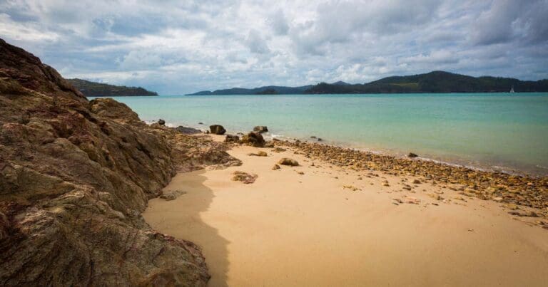
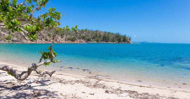
Hamilton Island is one of the few Whitsunday Islands that isn't part of the National Park, but it's every bit as beautiful. You can forget that you are on a populated resort island so easily on one of the many walks, and the views are to die for!
Though it's been inhabited for close to 8,000 years, Hamilton Island remains very much a pristine, natural environment. From its original settlement by the Ngaro people, to its visit by Captain Cook in 1770, and evolution as a tourist destination in the 1970s and 1980s, Hamilton Island has had a long and interesting history. The island was purchased by renowned Australian winemaker, Bob Oatley, in 2003, and since, has become one of the world's leading holiday destinations.
While there is an abundance of restaurants, bars and resorts on Hamilton Island, only a third of the island is developed - meaning the rest remains in its pristine, natural state. There are more than a dozen walking trails through which guests can explore the island.
Explore Safe
While planning your hike, it’s important to check official government sources for updated information, temporary closures and trail access requirements. Before hitting the trail, check local weather and bushfire advice for planned burns and bushfire warnings and let someone know before you go. Plan ahead and hike safely.
Let someone know
Adventure with peace of mind: Fill out your trip intentions form. Before you hit the trail, fill out an online form to privately send important details about your hike to your family or friends. If you don’t return on time, they can easily alert emergency services, preventing worry and ensuring a swift response. Hike with peace of mind and enjoy your outdoor adventure to the fullest. Be smart, be safe: Register your plans here.
Gear to consider
What you carry in your pack will depend on the weather, terrain, time of year, type of adventure, and personal preferences. Having trouble deciding what gear’s right for you? My free planning, food and packing checklists provide an introduction to things your could consider (as well as the Ten Essentials) on your day, overnight and multi-day adventures. Customise your kit according to your personal needs, always considering safety first.
Suggest an edit
Trail changed? New features discovered? Has the route changed? Trail permanently closed? Help fellow hikers by suggesting edits! Click above to update route descriptions, GPX file, trail features (like boardwalks), or access conditions (like parking availability). Help me keep the trails info fresh!
Weather
Acknowledgement of Country
Trail Hiking Australia acknowledges the Traditional Owners of the lands on which we hike and pay respects to their Elders, past and present, and we acknowledge the First Nations people of other communities who may be here today.


