Trail Fast Facts
Rawnsley Bluff and Wilpena Pound Lookout is an 10.5km, grade 4 hike in Rawnsley Park Station, South Australia. This hike typically takes 4 hours to complete.
Hike Overview
The Rawnsley Bluff and Wilpena Pound Lookout hike offers a challenging yet rewarding exploration of Rawnsley Park Station's dramatic landscapes. This 10.5km grade 4 hike takes approximately 4 hours to complete and provides stunning panoramic views throughout.
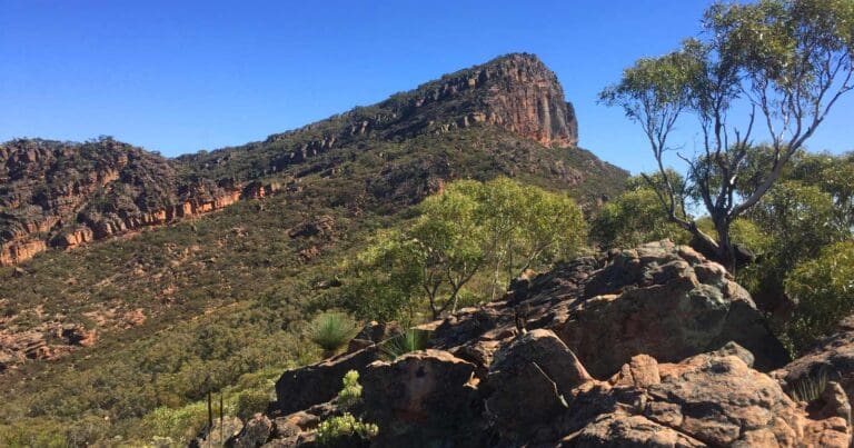
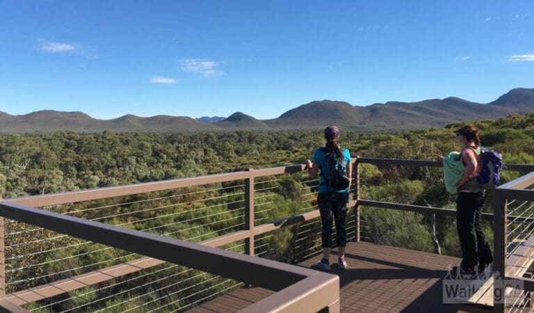
The trail begins at the Rawnsley Park Station carpark, winding alongside a creek bed before ascending the foothills of the Bonney Sandstone range. The initial incline gradually intensifies until reaching Lone Pine Lookout, where you'll be rewarded with breathtaking vistas along the escarpment and towards the Elder Range. The path then eases as you approach the summit.
Wilpena Pound Lookout grants a captivating perspective into the heart of Wilpena Pound, while Rawnsley Bluff boasts a historical marker - a dry stone survey cairn constructed by Samuel Parry in 1858 for trigonometrical surveying purposes. The bluff's namesake, H.C. Rawnsley, obtained his title through deceit by claiming to be a surveyor, though his incompetence was exposed within months.
For those seeking a shorter option, a fork appears on the escarpment. Taking the left turn leads to Wilpena Pound Lookout within 600 metres (4-hour return trip). The right fork continues for another 1.5km to Rawnsley Bluff, extending the return trip to 5 hours. Hikers with extra energy can add an optional 1.2km return walk from the carpark to Twidale Top.
Track Grade
Grade 4 (Hard) - Challenging Walks for Experienced Walkers: Grade 4 on the AWTGS signifies challenging walking tracks. Bushwalking experience is recommended for these tracks, which may be long, rough, and very steep. Directional signage may be limited, requiring a good sense of navigation. These walks are suited for experienced walkers who are comfortable with steeper inclines, rougher terrain, and potentially longer distances.
Map and GPX file
Max elevation: 932 m
Min elevation: 472 m
Total climbing: 584 m
Total descent: -584 m
Trailhead
Sorry, no records were found. Please adjust your search criteria and try again.
Sorry, unable to load the Maps API.
Getting there
Rawnsley Park Station is situated near the town of Hawker in South Australia. Travel via the Main North Road, then take the Port Wakefield Road and Northern Expressway. From Lyndoch, follow the Barossa Valley Way and continue through various towns including James Town, Orroroo and Hawker. Signage will guide you to the station from Hawker, which is approximately 35 kilometres north.
Photo gallery
If you’ve got some great shots from this hike, I’d love to see them! Please upload your .jpg files here to help inspire other hikers and show off the beauty of the trail.
A quick note: Uploading your photos doesn’t mean you lose ownership. You’ll be credited for any photos you share, and you can request to have them removed at any time.
About the region
Nestled on the southern slopes of Wilpena Pound near the town of Hawker, Rawnsley Park Station boasts a rich history intertwined with the Flinders Ranges. Established in 1851, it was originally part of Arkaba Station, one of the first pastoral leases granted in the region. These early leases, issued by the Colony of South Australia, opened up vast tracts of land for grazing.
The station's name is linked to Rawnsley Bluff, the southern tip of Wilpena Pound. The exact origin of the bluff's name remains a local mystery. H.C. Rawnsley, an Englishman who arrived under the pretense of being a surveyor, spent a brief period supposedly mapping the area between Mount Remarkable and Wilpena before being recalled by the government. Debate persists as to whether the prominent landmark was named after him or his deception led to the moniker.
Since 1953, Rawnsley Park Station has been owned and managed by the Smith family. Initially focused on sheep grazing, the station saw a shift in 1968 with the introduction of tourist accommodation and sheep shearing demonstrations. Under the leadership of Tony and Julieanne Smith, who took over management in 1985, the property has transformed into a thriving tourism destination, attracting over 20,000 visitors annually. Despite this focus on tourism, the station maintains a working sheep flock of approximately 2,000.
Beyond its historical significance, Rawnsley Park Station offers a haven for visitors seeking to explore the natural wonders of the Flinders Ranges. The surrounding landscape provides a network of walking trails catering to a range of fitness levels, making it an ideal base for those wanting to immerse themselves in the breathtaking scenery of this iconic region.
Suggest an edit
Spotted a change on this trail? Maybe there are new features, the route has shifted, or the trail is permanently closed. Whatever the update, I’d love your input. Your feedback helps fellow hikers stay informed and ensures that our trail info stays fresh and reliable.
Similar trails nearby
Looking for things to do in Rawnsley Park Station or nearby? Try these similar hikes or bushwalks.
Let someone know
Adventure with Confidence: Register Your Trip Plans
Before you hit the trail, take a moment to fill out our trip intentions form. It’s a simple way to share important details about your hike with family or friends. If things don’t go as planned and you’re not back on time, they can easily notify emergency services, helping to ensure a quick response and reducing worry. Enjoy your outdoor adventure knowing that you’ve taken a smart step for your safety.
Gear to consider
What you carry in your pack will depend on the weather, terrain, time of year, type of adventure, and personal preferences. Having trouble deciding what gear’s right for you? My free planning, food and packing checklists provide an introduction to things your could consider (as well as the Ten Essentials) on your day, overnight and multi-day adventures. Customise your kit according to your personal needs, always considering safety first.
Explore Safe
While planning your hike, it’s important to check official government sources for updated information, temporary closures and trail access requirements. Before hitting the trail, check local weather and bushfire advice for planned burns and bushfire warnings and let someone know before you go. Plan ahead and hike safely.
Weather
Acknowledgement of Country
Trail Hiking Australia acknowledges the Traditional Owners of the lands on which we hike and pay respects to their Elders, past and present, and we acknowledge the First Nations people of other communities who may be here today.


