Trail Fast Facts
Talyuberlup Walk Trail is a 2.6km, grade 5 hike in Stirling Range National Park, Western Australia. This hike typically takes 1.5 hours to complete.
Warning
This trail is extremely challenging, featuring a very rough surface and steep hills, requiring significant rock hopping and scrambling. Directional signage is limited or nonexistent. It is suitable only for highly experienced bushwalkers with advanced navigation skills, emergency first aid knowledge, and a high level of fitness.
Hike Overview
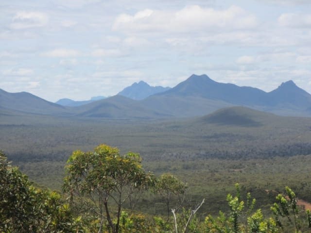
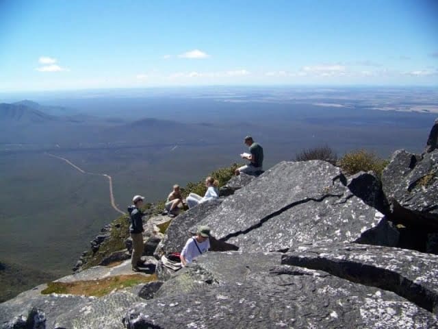
The Talyuberlup Walk Trail is a steep and challenging 2.6-kilometre return hike leading to a rocky peak that offers exceptional views and an array of wildflowers. This grade 5 hike, located in Stirling Range National Park, Western Australia, typically takes around 1.5 hours to complete and features a maze of gullies, caves, and rocky outcrops for exploration.
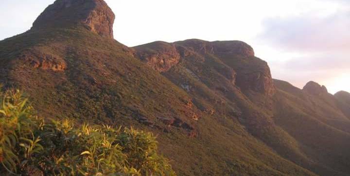
Talyuberlup is the most dramatic rock peak in the Stirling Ranges, rising to 783 metres. Its jagged, pinnacled summit resembles a castle, providing a striking visual backdrop. The trail begins by winding through low woodland before steeply ascending a gully, then progressing towards the base of the cliffs. Hikers will navigate along the cliff line and enter a large cave that tunnels beneath the summit, eventually emerging onto the peak of Talyuberlup. The ascent covers a vertical distance of 600 metres over 1.3 kilometres, and caution is advised as the path can become treacherous when wet.
Track Grade
Grade 5 (Difficult) - Walks for the Most Experienced: Grade 5 represents the most challenging walking tracks on the AWTGS. These are only recommended for very experienced and fit walkers with specialised skills, including navigation and emergency first aid. Tracks are likely to be very rough, very steep, and unmarked. Walks may be more than 20 kilometers. These challenging walks demand a high level of fitness and experience to navigate difficult terrain, significant elevation changes, and potentially unformed paths.
Tips
- Standard park entry fees apply for Stirling Range National Park.
- The Stirling Range experiences unpredictable weather. Hikers should be aware of the possibility of sudden temperature drops, rain, or hail.
- Hikers planning to venture off marked trails, abseil, or rock climb should register at the shelter across from the Bluff Knoll Road entry station picnic area. This helps park rangers be aware of your location in case of emergencies.
Map and GPX file
Max elevation: 709 m
Min elevation: 354 m
Total climbing: 362 m
Total descent: -362 m
Trailhead
Sorry, no records were found. Please adjust your search criteria and try again.
Sorry, unable to load the Maps API.
Getting there
The trailhead is located on Stirling Range Drive within Stirling Range National Park, approximately 430 kilometres (about a five-hour drive) south of Perth.
Photo gallery
If you’ve got some great shots from this hike, I’d love to see them! Please upload your .jpg files here to help inspire other hikers and show off the beauty of the trail.
A quick note: Uploading your photos doesn’t mean you lose ownership. You’ll be credited for any photos you share, and you can request to have them removed at any time.
About the region
Stirling Range National Park is home to the only significant mountain range in the southern region of Western Australia, with peaks exceeding 1,000 metres above sea level. This unique landscape provides a challenging and spectacular hiking experience. The Aboriginal name for the range, Koi Kyenunu-ruff, translates to ‘mist rolling around the mountains,’ a phenomenon that frequently occurs in the area.
During spring and early summer, the ranges come alive with an abundance of wildflowers and birdlife, which can be observed from various hiking trails, lookouts, and picnic areas throughout the park. For those who prefer not to hike, a 42-kilometre scenic drive on mostly unsealed, graded roads winds through the heart of the park, offering numerous stops along the way.
Accommodation options include the Stirling Range Retreat and the Mount Trio Bush Camping and Caravan Park, both situated on the northern boundary of the park. Bluff Knoll, known as Bular Mial, holds cultural significance for the Minang and Goreng people, and informative signage at the Eastern Lookout shares valuable insights and stories about the area.
The peaks of the Stirling Range are prone to rapid and unpredictable weather changes, so hikers must be prepared for sudden cool changes that can bring temperature drops, rain, or hail. All visitors are strongly advised to avoid entering the bush or using footpaths during days of extreme fire danger. Those planning to hike off marked trails, as well as those intending to abseil or rock climb, should register their details at the shelter located in the picnic area across from the Bluff Knoll Road entry station. Registration is not required for those hiking established trails.
Recognition and acknowledgement are given to the Goreng and Menang people as the Traditional Owners of Stirling Range National Park.
Suggest an edit
Spotted a change on this trail? Maybe there are new features, the route has shifted, or the trail is permanently closed. Whatever the update, I’d love your input. Your feedback helps fellow hikers stay informed and ensures that our trail info stays fresh and reliable.
Similar trails nearby
Looking for things to do in Stirling Range National Park or nearby? Try these similar hikes or bushwalks.
Let someone know
Adventure with Confidence: Register Your Trip Plans
Before you hit the trail, take a moment to fill out our trip intentions form. It’s a simple way to share important details about your hike with family or friends. If things don’t go as planned and you’re not back on time, they can easily notify emergency services, helping to ensure a quick response and reducing worry. Enjoy your outdoor adventure knowing that you’ve taken a smart step for your safety.
Gear to consider
What you carry in your pack will depend on the weather, terrain, time of year, type of adventure, and personal preferences. Having trouble deciding what gear’s right for you? My free planning, food and packing checklists provide an introduction to things your could consider (as well as the Ten Essentials) on your day, overnight and multi-day adventures. Customise your kit according to your personal needs, always considering safety first.
Explore Safe
While planning your hike, it’s important to check official government sources for updated information, temporary closures and trail access requirements. Before hitting the trail, check local weather and bushfire advice for planned burns and bushfire warnings and let someone know before you go. Plan ahead and hike safely.
Weather
Acknowledgement of Country
Trail Hiking Australia acknowledges the Traditional Owners of the lands on which we hike and pay respects to their Elders, past and present, and we acknowledge the First Nations people of other communities who may be here today.


