Trail Fast Facts
Tiara walking track is a 5km, grade 4 hike in Oxley Wild Rivers National Park, New South Wales. This hike typically takes 2.5 hours to complete.
Hike Overview
The Tiara Walking Track in Oxley Wild Rivers National Park is a rewarding 5km (grade 4) adventure for those seeking breathtaking views and a taste of the park's diverse landscapes. This moderately challenging hike takes roughly 2.5 hours to complete and is a fantastic introduction to the park's natural wonders.
The adventure begins at the Tia Falls picnic area, a convenient starting point. Your initial challenge involves crossing the Tia River, where you might be lucky enough to spot a platypus paddling in the crystal-clear water.
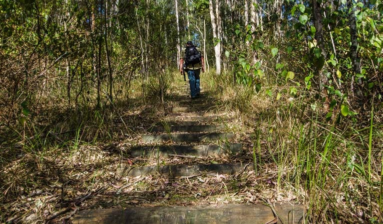
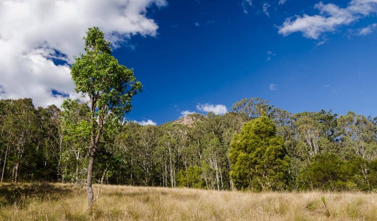
Following the western ridge, the trail transitions through a variety of ecosystems. Lush grassy woodlands and dry gum forests offer a glimpse into the park's diverse vegetation. Keep your eyes peeled – you might be fortunate enough to catch a glimpse of a koala perched in the branches of a gum tree, or a brush-tailed rock wallaby nestled amongst the rocky outcrops.
As you delve deeper, the landscape transforms into a fascinating dry rainforest. Here, delicate rock orchids cling to the trunks of the scentless rosewood and native olive trees, adding a touch of beauty to this unique habitat.
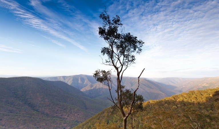
An optional detour leads you to Tiara View lookout, offering a breathtaking panorama across the river-gouged valleys. The main track continues, eventually culminating at the Tiara Lookout. Here, take a moment to reward yourself with the most spectacular views – a vista of dramatic gorge country that will leave you speechless.
Track Grade
Grade 4 (Hard) - Challenging Walks for Experienced Walkers: Grade 4 on the AWTGS signifies challenging walking tracks. Bushwalking experience is recommended for these tracks, which may be long, rough, and very steep. Directional signage may be limited, requiring a good sense of navigation. These walks are suited for experienced walkers who are comfortable with steeper inclines, rougher terrain, and potentially longer distances.
Map and GPX file
Max elevation: 1061 m
Min elevation: 1000 m
Total climbing: 243 m
Total descent: -243 m
Trailhead
Sorry, no records were found. Please adjust your search criteria and try again.
Sorry, unable to load the Maps API.
Getting there
The Tiara Walking Track is situated within the Tia Falls precinct of Oxley Wild Rivers National Park. This convenient location makes it an accessible option for those traveling along the Oxley Highway.
If you're driving from Walcha, follow the Oxley Highway. Be sure to keep an eye out for the turn-off to Tia Falls, which is located approximately 19 kilometers past the Apsley Gorge turn-off. The road leading to the trailhead is unsealed, so the distance is listed as 7 kilometers, though it may take slightly longer to traverse.
Weather conditions can significantly impact the road leading to the Tiara Walking Track. It's crucial to check the forecast before you set out, as the road can become boggy after rainfall.
Parking is available at the designated Tia Falls lookout and picnic area. This eliminates the hassle of searching for parking after your scenic drive and allows you to seamlessly begin your adventure on the Tiara Walking Track.
Photo gallery
If you’ve got some great shots from this hike, I’d love to see them! Please upload your .jpg files here to help inspire other hikers and show off the beauty of the trail.
A quick note: Uploading your photos doesn’t mean you lose ownership. You’ll be credited for any photos you share, and you can request to have them removed at any time.
About the region
Immerse Yourself in Wild Beauty: Oxley Wild Rivers National Park. Oxley Wild Rivers National Park, a World Heritage-listed Gondwana rainforest sanctuary near Armidale, stuns visitors with its dramatic gorges, magnificent waterfalls, and rare dry rainforests. Explore scenic drives along the Waterfall Way, or delve deeper with multi-day hikes like the Green Gully walk, offering overnight stays in heritage-listed stockman's huts. For a touch of luxury, stay at East Kunderang Homestead.
Camping, walking, paddling, picnicking, cycling, horse riding – Oxley Wild Rivers National Park caters to every outdoor enthusiast. Hike through diverse landscapes – wet and dry eucalypt forests, grassy woodlands, and heathlands. Keep an eye out for native flora like olive trees, lacebarks, and towering stinging trees.
Dramatic ridges, towering rock formations, and cascading waterfalls create a breathtaking backdrop for your exploration. Gaze upon the majestic Wollomombi Falls, the highest in New South Wales, or spot a wedge-tailed eagle soaring on the thermals.
Make the most of your Oxley Wild Rivers National Park adventure by checking the park website for current conditions, permits, and specific activity details.
Suggest an edit
Spotted a change on this trail? Maybe there are new features, the route has shifted, or the trail is permanently closed. Whatever the update, I’d love your input. Your feedback helps fellow hikers stay informed and ensures that our trail info stays fresh and reliable.
Similar trails nearby
Looking for things to do in Oxley Wild Rivers National Park or nearby? Try these similar hikes or bushwalks.
Let someone know
Adventure with Confidence: Register Your Trip Plans
Before you hit the trail, take a moment to fill out our trip intentions form. It’s a simple way to share important details about your hike with family or friends. If things don’t go as planned and you’re not back on time, they can easily notify emergency services, helping to ensure a quick response and reducing worry. Enjoy your outdoor adventure knowing that you’ve taken a smart step for your safety.
Gear to consider
What you carry in your pack will depend on the weather, terrain, time of year, type of adventure, and personal preferences. Having trouble deciding what gear’s right for you? My free planning, food and packing checklists provide an introduction to things your could consider (as well as the Ten Essentials) on your day, overnight and multi-day adventures. Customise your kit according to your personal needs, always considering safety first.
Explore Safe
While planning your hike, it’s important to check official government sources for updated information, temporary closures and trail access requirements. Before hitting the trail, check local weather and bushfire advice for planned burns and bushfire warnings and let someone know before you go. Plan ahead and hike safely.
Weather
Acknowledgement of Country
Trail Hiking Australia acknowledges the Traditional Owners of the lands on which we hike and pay respects to their Elders, past and present, and we acknowledge the First Nations people of other communities who may be here today.


