Trail Fast Facts
Z Bend River Trail is a 2.6km, grade 4 hike in Kalbarri National Park, Western Australia. This hike typically takes 1.5 hours to complete.
Hike Overview
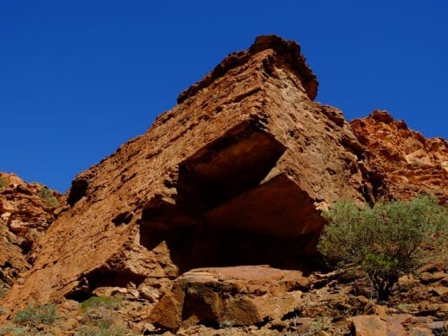
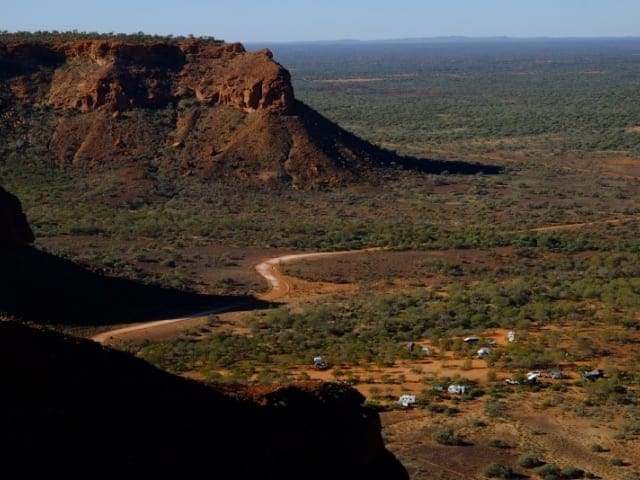
The Z Bend in Kalbarri National Park is a captivating natural wonder, aptly named for the dramatic twists carved by the Murchison River into the Tumblagooda Sandstone gorge. This location offers a two-fold adventure – breathtaking views from the lookout and a challenging hike down into the gorge itself.
Start your Z Bend experience with a visit to the lookout. Conveniently located a short distance from the car park (accessible by 2WD vehicle), this wheelchair-accessible viewpoint offers stunning panoramic views of the gorge. Take in the impressive scale of the landscape and appreciate the river's relentless power in shaping the sandstone over time.
For thrill-seeking hikers, the Z Bend River Trail calls. This 2.6-kilometer, grade 4 return hike is designed for experienced adventurers with a good level of fitness. The trail descends down into the gorge, leading you through passages, over boulders, and down ladders. Keep your eyes peeled for the Kalbarri Spider Orchid, a rare endemic wildflower, alongside other colorful blooms that may be gracing the landscape.
Once you reach the gorge floor, the reward awaits. Take a refreshing dip in the Murchison River (during permitted seasons) or simply enjoy a peaceful walk along the riverbank, surrounded by the serene beauty of the gorge.
The Z Bend River Trail is classified as difficult due to the uneven terrain, potential for steep inclines or descents, and sections requiring rock scrambling. Directional signage may be limited, so prior bushwalking experience, navigation skills, and emergency first-aid knowledge are highly recommended. The steep descent, ladders, tight passages, and boulder climbing require a good level of physical fitness and agility. Remember, extreme caution is necessary when navigating gorge environments.
Tips
- The summer months (December to April) can be scorching, so plan your hike for cooler parts of the day and ensure you carry sufficient water to stay hydrated.
Map and GPX file
Max elevation: 157 m
Min elevation: 89 m
Total climbing: 123 m
Total descent: -123 m
Trailhead
Sorry, no records were found. Please adjust your search criteria and try again.
Sorry, unable to load the Maps API.
Track Grade
Grade 4 (Hard) - Challenging Walks for Experienced Walkers: Grade 4 on the AWTGS signifies challenging walking tracks. Bushwalking experience is recommended for these tracks, which may be long, rough, and very steep. Directional signage may be limited, requiring a good sense of navigation. These walks are suited for experienced walkers who are comfortable with steeper inclines, rougher terrain, and potentially longer distances.
Getting there
The starting point for both the lookout and the Z Bend River Trail is the Z Bend Lookout Car Park, situated along Z Bend Road within Kalbarri National Park. This location is approximately 585 kilometers north of Perth, translating to a 6-hour drive.
Photo gallery
If you’ve got some great shots from this hike, I’d love to see them! Please upload your .jpg files here to help inspire other hikers and show off the beauty of the trail.
A quick note: Uploading your photos doesn’t mean you lose ownership. You’ll be credited for any photos you share, and you can request to have them removed at any time.
About the region
Kalbarri National Park pays respect to the Nanda people as the traditional custodians of this land. The park itself encompasses the lower Murchison River, where the river has carved a magnificent 80km gorge through red and white banded sandstone. A breathtaking perspective of this natural wonder can be obtained from the Kalbarri Skywalk, a dual-platform structure jutting out over the gorge. Numerous walking trails descend into the gorge, allowing visitors to experience its colorful splendor firsthand.
The park also boasts an impressive coastline sculpted by wind and wave erosion. Here, towering cliffs plunge 100 meters towards the ocean, offering equally stunning vistas. Particularly during spring, the wildflowers blanketing the landscape add another layer of vibrant beauty.
The town of Kalbarri, situated at the mouth of the Murchison River, serves as a vibrant hub for both fishing and tourism. This town provides a convenient base for exploring the park's many offerings. Activities range from sightseeing and picnicking to more adventurous pursuits like abseiling, rafting, and canoeing. Don't forget to book tours in advance for these activities to ensure a spot.
With so much to see and do, allow ample time to fully experience Kalbarri National Park. For panoramic vistas of Murchison Gorge, be sure to venture out onto the Kalbarri Skywalk. It's important to note that summer temperatures can be extreme. To ensure a safe and enjoyable visit, plan hikes during the cooler months (May to October). When embarking on hikes, prioritize safety: start early in the morning, carry sufficient water (1 liter per hour per person), wear sun protection, comfortable clothing, and sturdy footwear. As there's no potable water available within the park, remember to bring your own supply.
Suggest an edit
Spotted a change on this trail? Maybe there are new features, the route has shifted, or the trail is permanently closed. Whatever the update, I’d love your input. Your feedback helps fellow hikers stay informed and ensures that our trail info stays fresh and reliable.
Similar trails nearby
Looking for things to do in Kalbarri National Park or nearby? Try these similar hikes or bushwalks.
Let someone know
Adventure with Confidence: Register Your Trip Plans
Before you hit the trail, take a moment to fill out our trip intentions form. It’s a simple way to share important details about your hike with family or friends. If things don’t go as planned and you’re not back on time, they can easily notify emergency services, helping to ensure a quick response and reducing worry. Enjoy your outdoor adventure knowing that you’ve taken a smart step for your safety.
Gear to consider
What you carry in your pack will depend on the weather, terrain, time of year, type of adventure, and personal preferences. Having trouble deciding what gear’s right for you? My free planning, food and packing checklists provide an introduction to things your could consider (as well as the Ten Essentials) on your day, overnight and multi-day adventures. Customise your kit according to your personal needs, always considering safety first.
Explore Safe
While planning your hike, it’s important to check official government sources for updated information, temporary closures and trail access requirements. Before hitting the trail, check local weather and bushfire advice for planned burns and bushfire warnings and let someone know before you go. Plan ahead and hike safely.
Weather
Acknowledgement of Country
Trail Hiking Australia acknowledges the Traditional Owners of the lands on which we hike and pay respects to their Elders, past and present, and we acknowledge the First Nations people of other communities who may be here today.


