Trip Report by Dean Herman – March 2018
A fascinating and beautiful walk
After 10 days straight of work, rostering was kind enough to allocate me a 4-day break. As usual, my first thought: where can I hike? I chose Lake Mountain and the Keppel Hut tracks for my walk this week. Considering my objectives for the weekend, it represented a number of challenges: rain, wind, new maps and trails, and chance to trial my new Base Layer.
I must admit, I am still quite a newbie at this hobby. I started seriously in August last year, and have been progressively pushing myself further, 9km’s, 15km, a valley climb, a rougher trail. Over that time I’ve also collected equipment and clothes to improve my experience. This weekend however, represented something a bit different: Autumn, cooling temperatures and changing conditions. The hike along the ridge lines of Lake Mountain seemed the perfect chance to step up into Alpine district for a journey more challenging on a number of levels.
My initial Itinerary was to commence at the Snowy Hill car park, complete the short journey over the summit of Lake Mountain to Gerraty’s, along the Royston, The Hutt and Panorama Trails to the northern extent of the Lake Mountain resort. From here you can leave the Alpine Resort area by heading north west along the Boundary Trails to the Keppel Hut. I had also planned to skirt around the Long Heath and Woollybutt trails but in the end, I chose to leave this for another day.
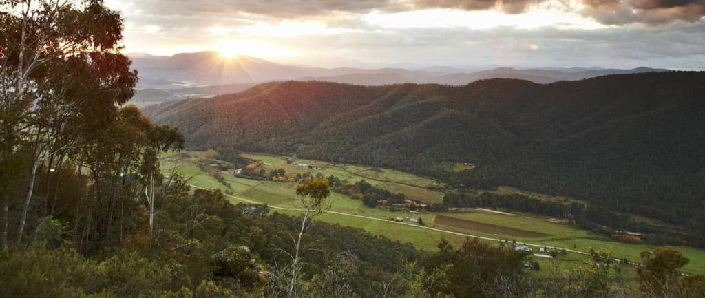
I arrived just after 8.30, my car a lonely, forlorn figure in a car park all on its own. I couldn’t help but think others were missing out. I headed north out of the car park towards the Alpine lookout, happy to have the trails to myself. The views, whilst limited by the incoming clouds, were incredibly impressive. The brooding and moody atmosphere, made all the more dramatic by the prevalence of ghostly grey tree trunks, a salient reminder of the 2009 fires. By the time I reached Lake Mountain summit, the rain had closed in. The low cloud formed a grey ceiling at 1,400 metres, I was about to find out if the investment in a woolen Base Layer was worth it.
Challenging enough to keep me motivated
It began to rain, the wind picked up, visibility reduced to a 100m or so. The change was as dramatic as it was swift. My outer layer consisted of some cotton cargo pants and a water-resistant coat, not overly sophisticated, I know, but I wasn’t going to be deterred. I continued on along the Royston Trail, the rain a constant companion for the next few hours. I found that over the distance traveled in these conditions I remained were and relatively dry where the Base Layer extended, and despite some cold knees, overall I felt quite warm and comfortable. I felt like that was a success.
Once I reached the Boundary Trail and Keppel Hut Track, the condition of the track changed significantly. Gone were the wide, graveled pathways and clear signs. The path converged to be a narrow gap in the vegetation, the familiar orange reflective triangles helped mark the way, but be certain to have a good map. At least in my view, with limited experience, the trail was not always evident, the orange markers can’t always be seen from the last one, a detailed map is appropriate. I kept a look out for the Gould Track and a number of others, however, they a long overgrown. I would not rely solely on the National Park’s “Park Notes” if walking along the trails outside of the resort as it does not provide great detail of this area.
I reached Keppels Hut in approximately 3 hours and noted that after moving quickly through the rain and the overgrown Boundary Trail, my choice of cotton cargo’s for an external layer appeared a little optimistic, they were now cold, soaked and heavy. The Hut however, represented a good chance to dry out and start again. It is stocked with dry kindling, firewood and matches, a quick camp fire helped get me dry and keep me warm. After a break of 2 hours or so, and ensuring my fire had been fully extinguished, I commenced the return journey. I have to say, that the concept of the Huts and the volunteers that maintain them, should be commended.
To save a little time and exposure, I returned via Old Taggerty Road. The road takes a leisurely route down from the Hutt and under the ridge line traversed by the Boundary Track. It crosses a number of streams and rivers, before climbing back up and out of the Taggerty River valley. The views from the road are equally spectacular as the higher walking trails but a touch easier on my knees. I returned to the Snowy Hill Car Park at 4.30pm, plenty of time to be on the road and headed home.
This is a fascinating and beautiful walk, challenging enough to keep me motivated.


How was the track condition down to Keppel Hut? Heavily overgrown and many many under and overs of large fallen trees at the start of December..